AAWT Guided Hiking Tour: Tharwa to Dead Horse Gap
AAWT Guided Hiking Tour: Tharwa to Dead Horse Gap
Overview
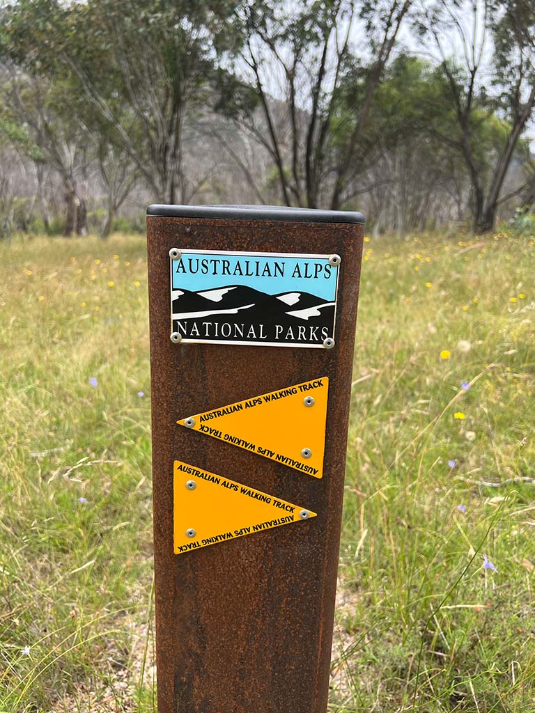
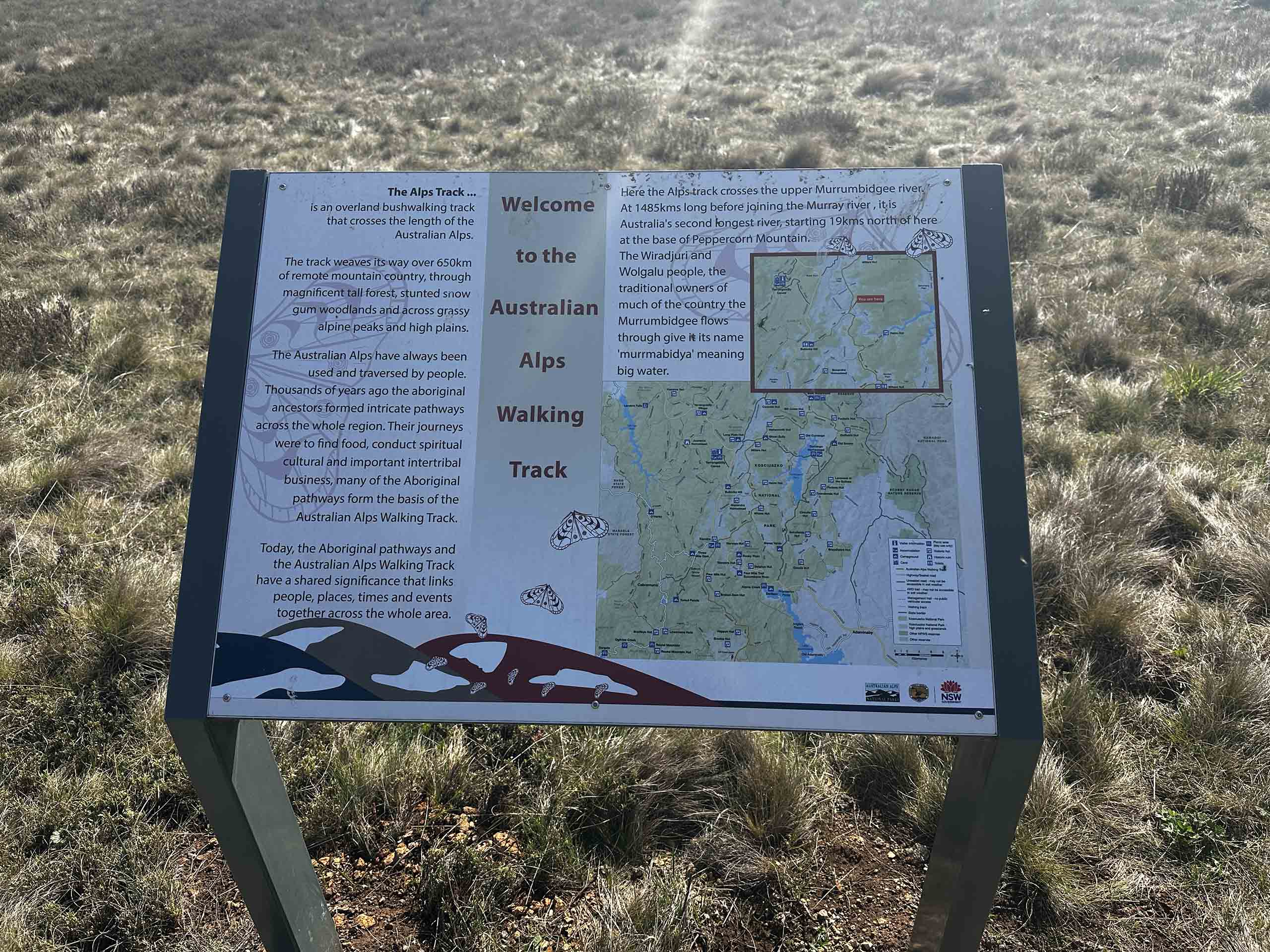
The Australian Alps Walking Track (AAWT) is Australia’s premier long-distance alpine bushwalk. At 680km in length, it traverses Australia’s finest high country between Tharwa (ACT) and Walhalla (VIC).
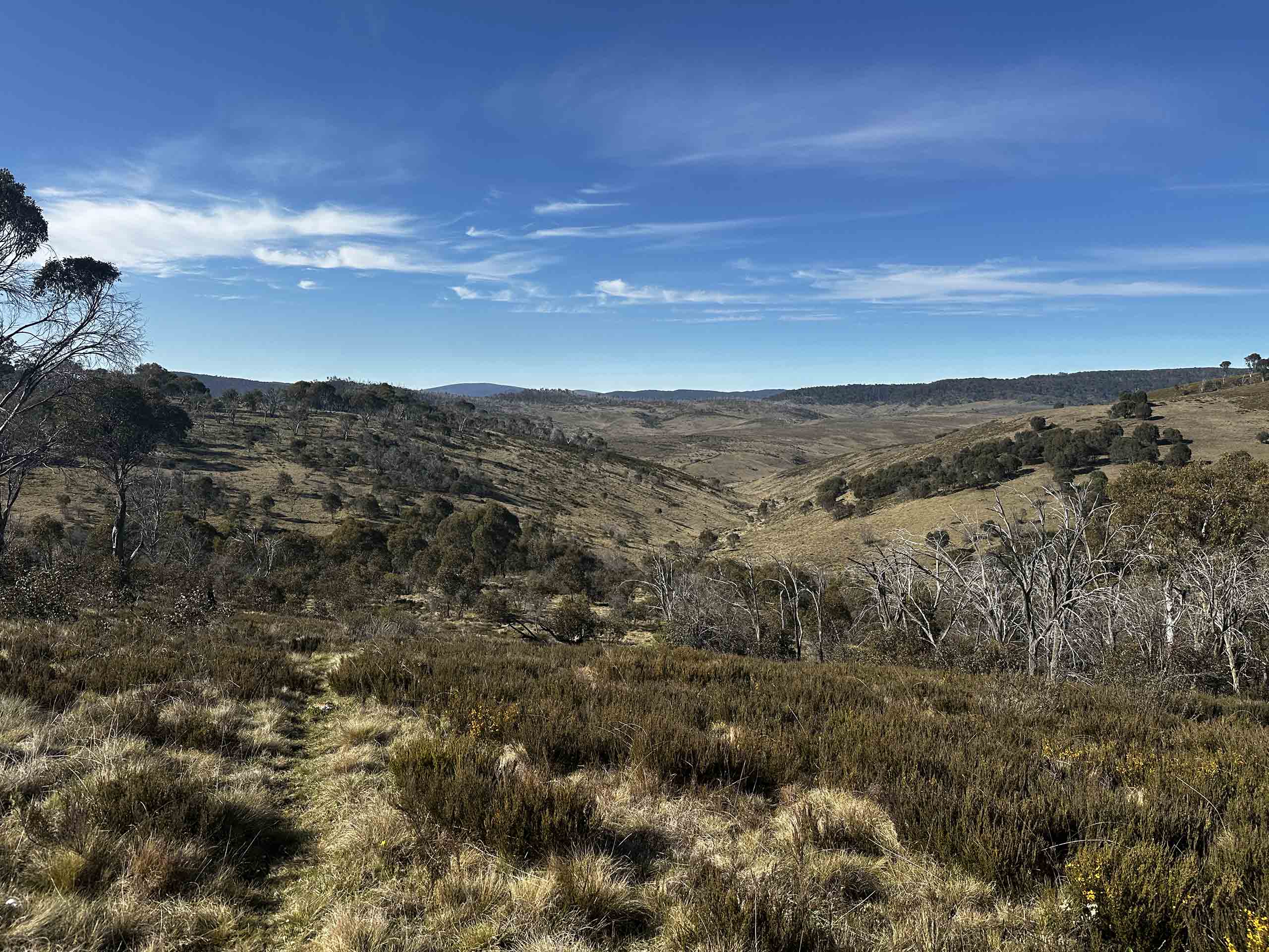
Passing through terrain that is inaccessible by vehicle, the track offers the potential to explore some of the most remote and rugged areas within Victoria, NSW, and the ACT. Unlike the standard tourist hikes of Australia, the remote nature of this route provides an authentic wilderness experience without the crowds.
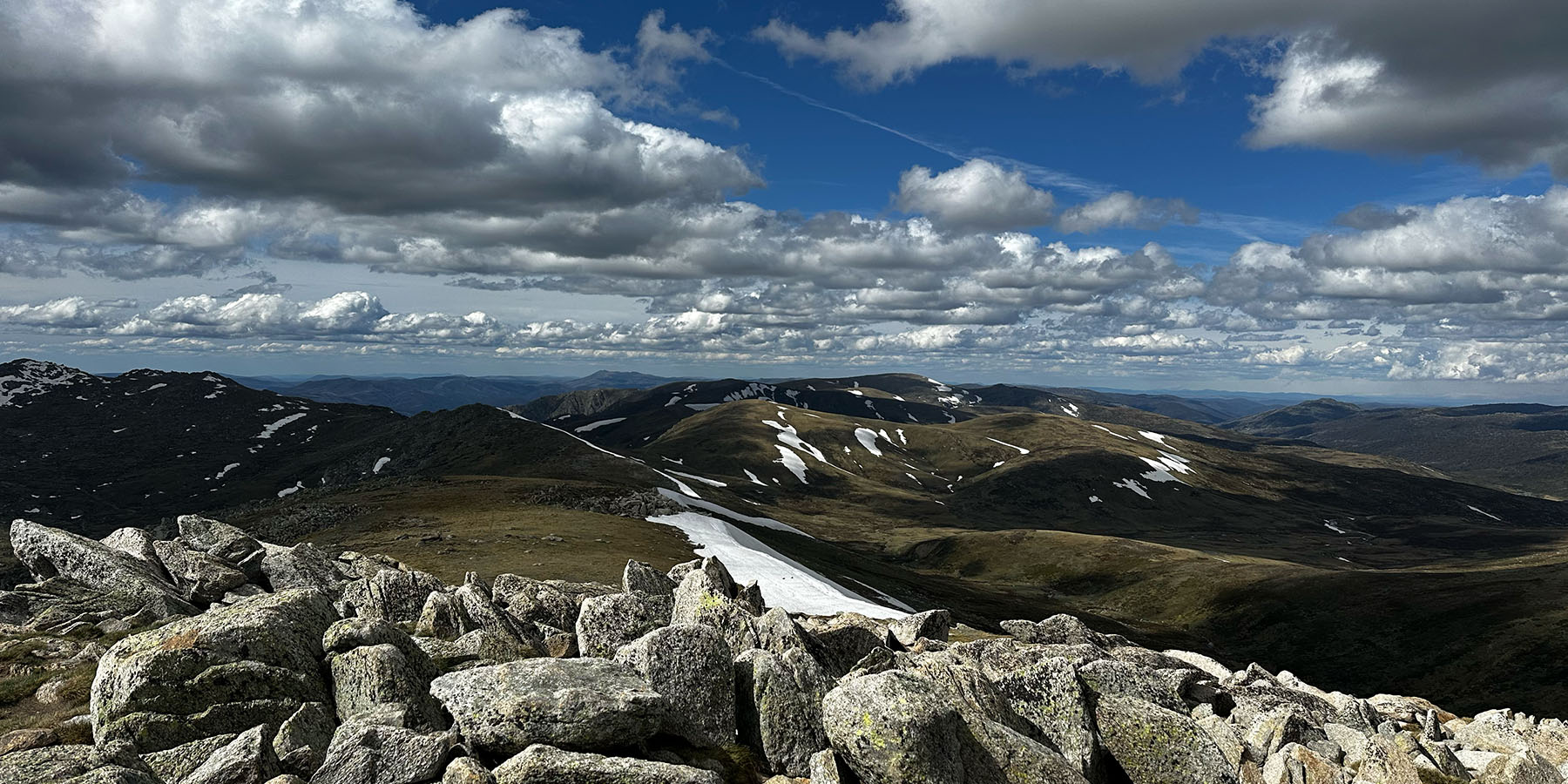
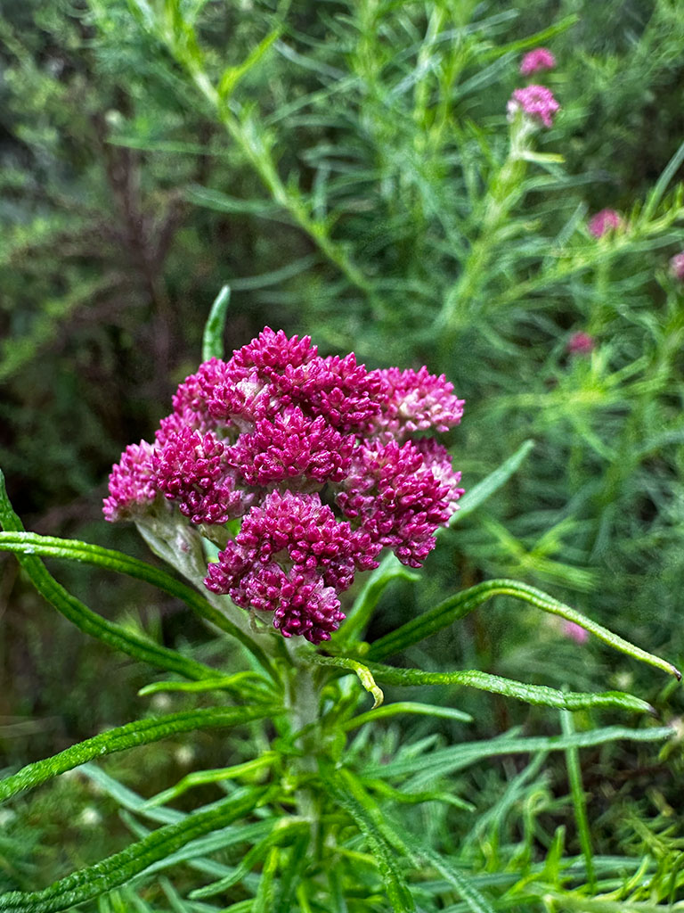
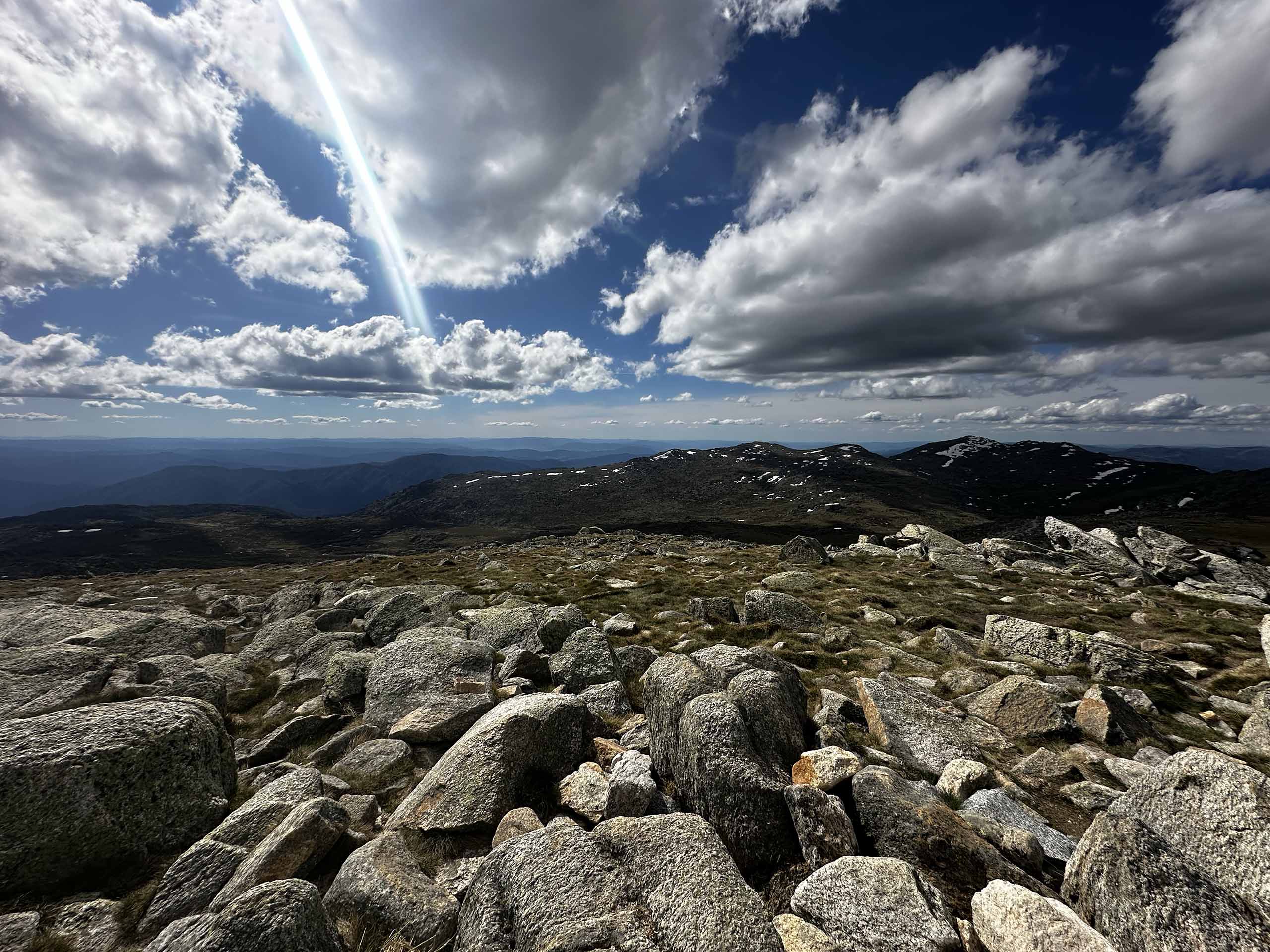
This trip tackles the northern third of the AAWT, from Tharwa (ACT) to Dead Horse Gap (NSW). Traversing the high plains of the Snowy Mountains, explore historic alpine huts, spot native wildflowers and summit Australia’s highest peak, Mount Kosciuszko.
On this trip you have the opportunity to develop your outdoor skills and knowledge. Our world-class guides are passionate about sharing their experience. Learn how to lighten your pack, nail your nutrition and navigate in the backcountry. Have the confidence to pursue unguided multi-day hiking trips or even take on a thru hike like the Pacific Crest Trail!
- Intimate group size - ( Guide to guest ratio of 1:3 )
- Exceptional pre-trip guidance and support - ( Be confident tackling the AAWT )
- Approximate pack weight below 10kg - ( Avoid sore shoulders and hips )
Have questions?
Send us a message.Key Features
- An isolated and quiet wilderness walking experience.
- Famous Australian alpine wildflowers and snow gums.
- A variety of track types including firetrails, single track, and off track walking.
- Many historic alpine huts (12+ depending on side trips taken).
- Walking through Namadgi and Kosciuszko National Park, including exploring Australia’s Snowy Mountains and summiting Mount Kosciuszko (the highest point in Australia).
Highlights
- Summit Mount Bimberi, the highest point in the ACT (optional side trip).
- Explore Blue Waterholes and the surrounding caves.
- Summit Mt Jagungal (optional side trip).
- Visit the head of Valentine Falls, which has a total drop of 120m (optional side trip).
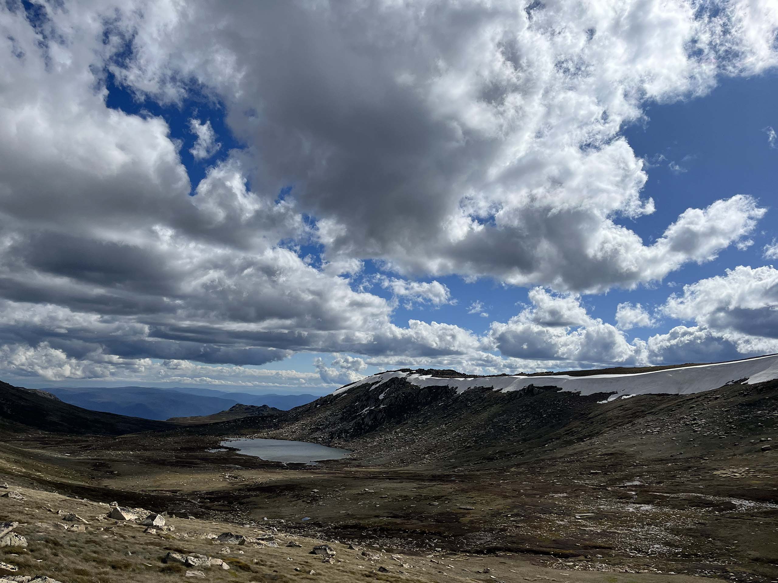
- Traverse the Rolling Grounds.
- Walk past Australia’s highest alpine lakes including Lake Cootapatamba, Club Lake, Blue Lake, and Lake Albina.
Itinerary
Meet your guides in Canberra the afternoon before the tour starts. You will receive all your gear (tent, sleeping bag, pack etc.) and we will do a final clothing check.
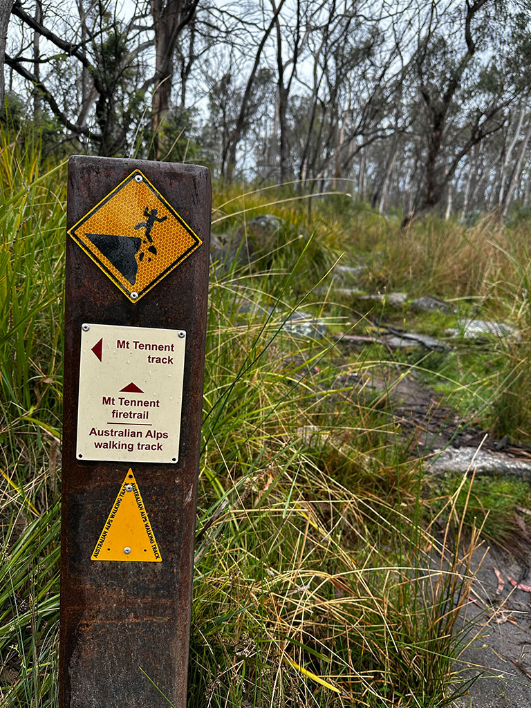
Day 1: Namadgi Visitor Centre - Honeysuckle Campground, 15.6km
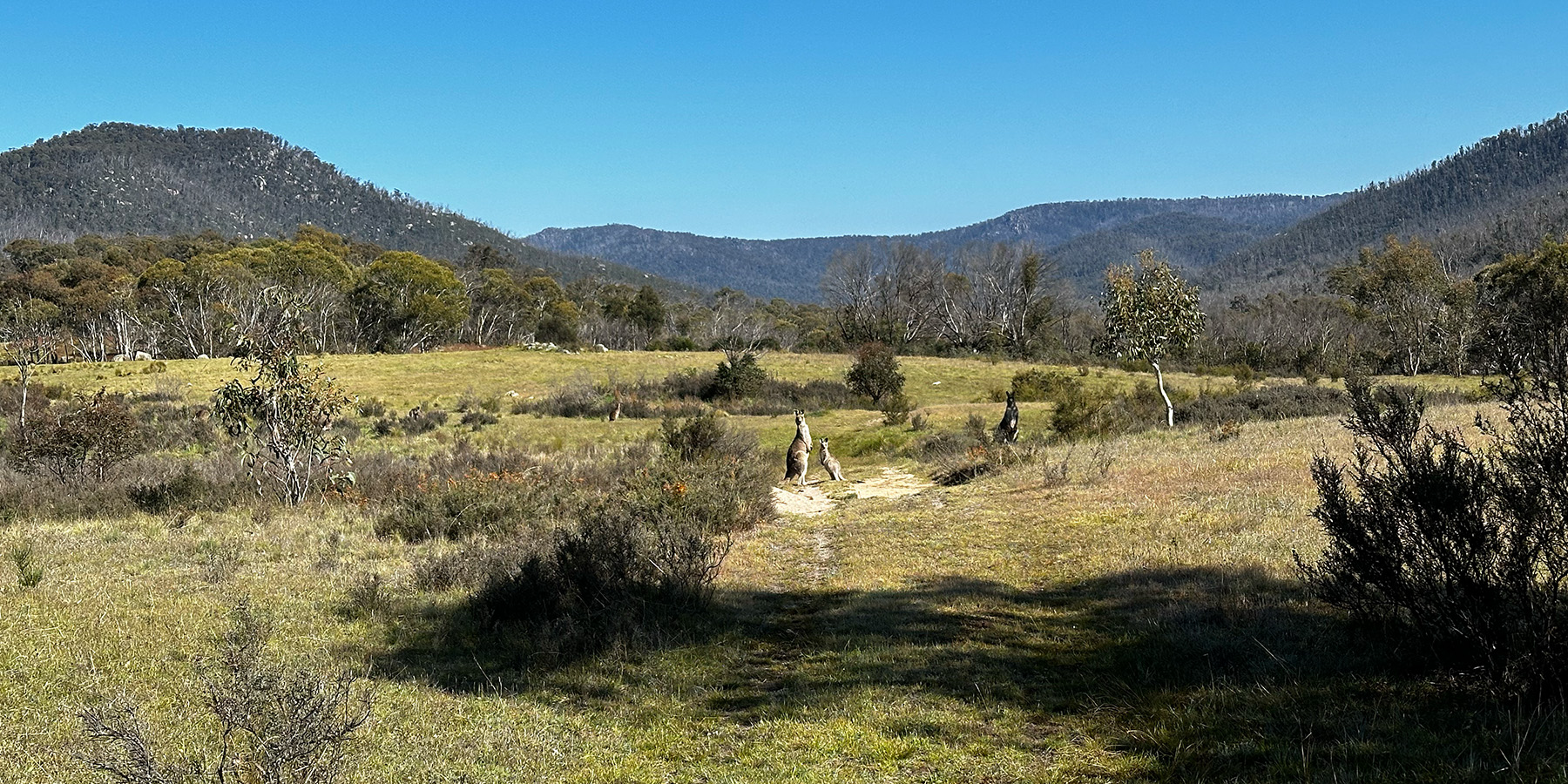
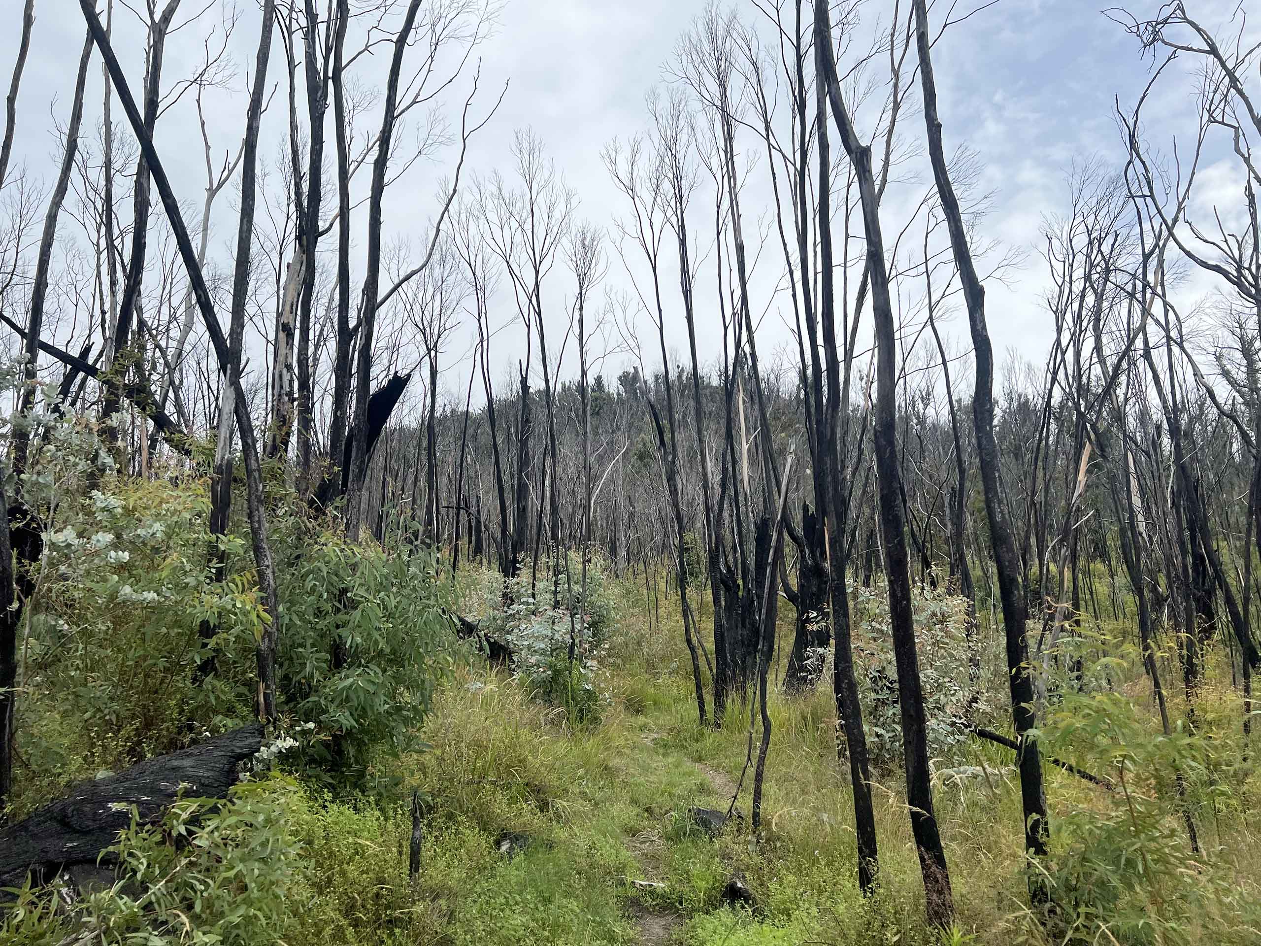
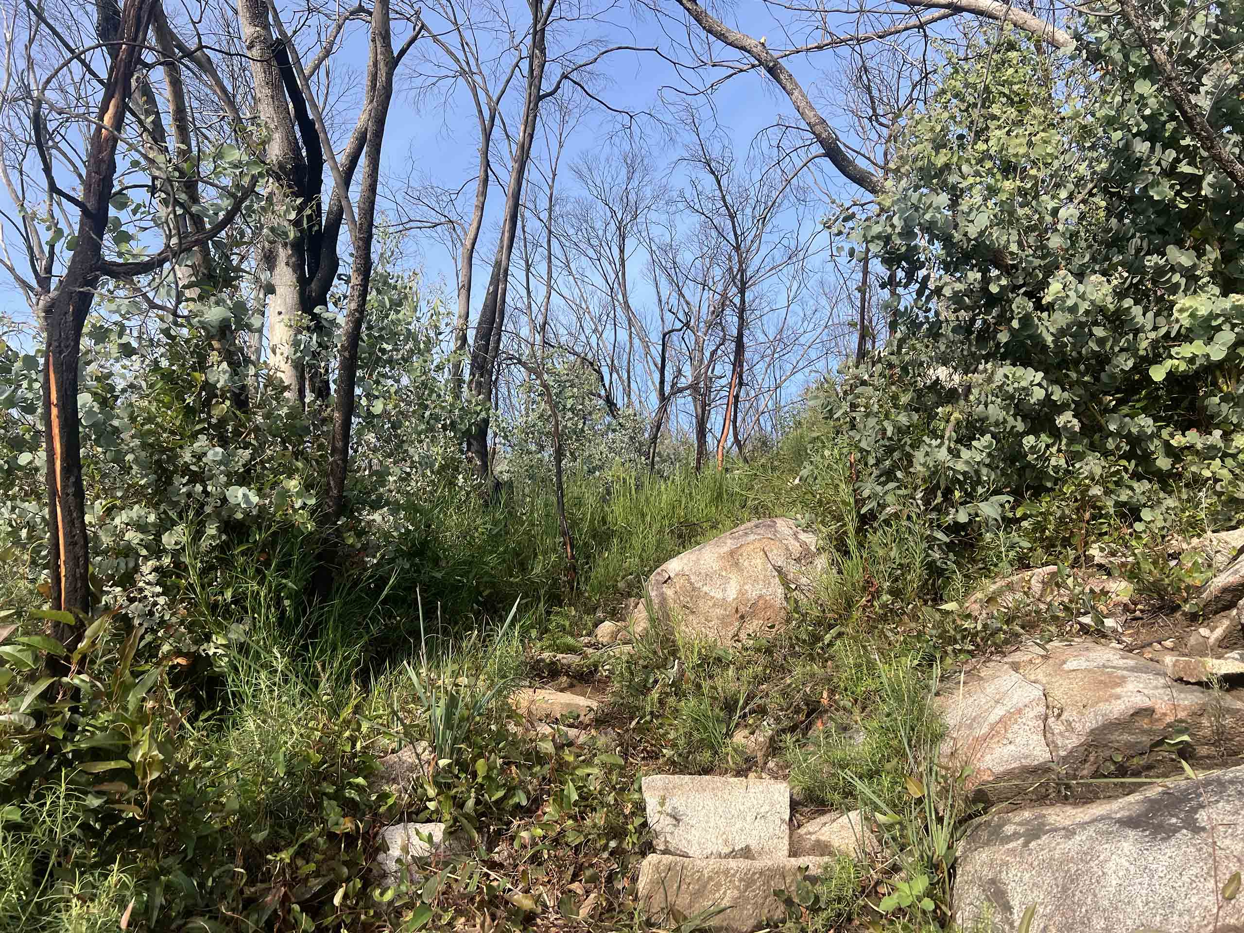
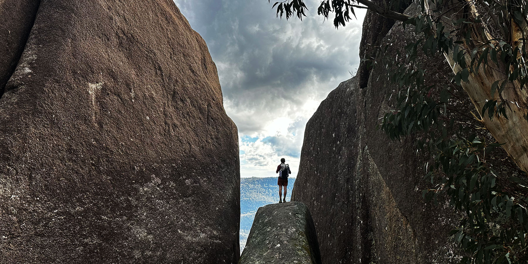
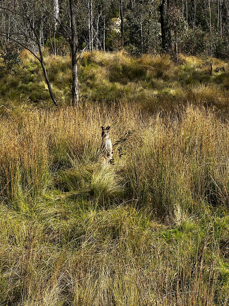
Meet your group at 7am in Canberra. We have a short drive to Namadgi Visitor Centre, the northern terminus of the Australian Alps Walking Track (AAWT). Then, we begin our trek through Namadgi National Park, climbing up towards Mt Tennent along rocky single-track. Descending into Bushfold Flats, spot native birdlife, wildflowers and wallabies as we trek through sections of eucalypt forest. Have the option to detour to Booroomba Rocks, Canberra’s largest granite cliffs. From the top, take in panoramic views of the Brindabellas in an area frequently visited by rock climbers for its challenging slabs and cracks. We finish our day at Honeysuckle campground. Here, we meet our support vehicle for dinner, and collect our food for the next few days.
Popular side trips:
- Mt Tennent (4.7km return)
- Booroomba Rocks (2.5km return)
Elevation Profile
Days 2-4: Honeysuckle Campground – Blue Waterholes, ~15km per day
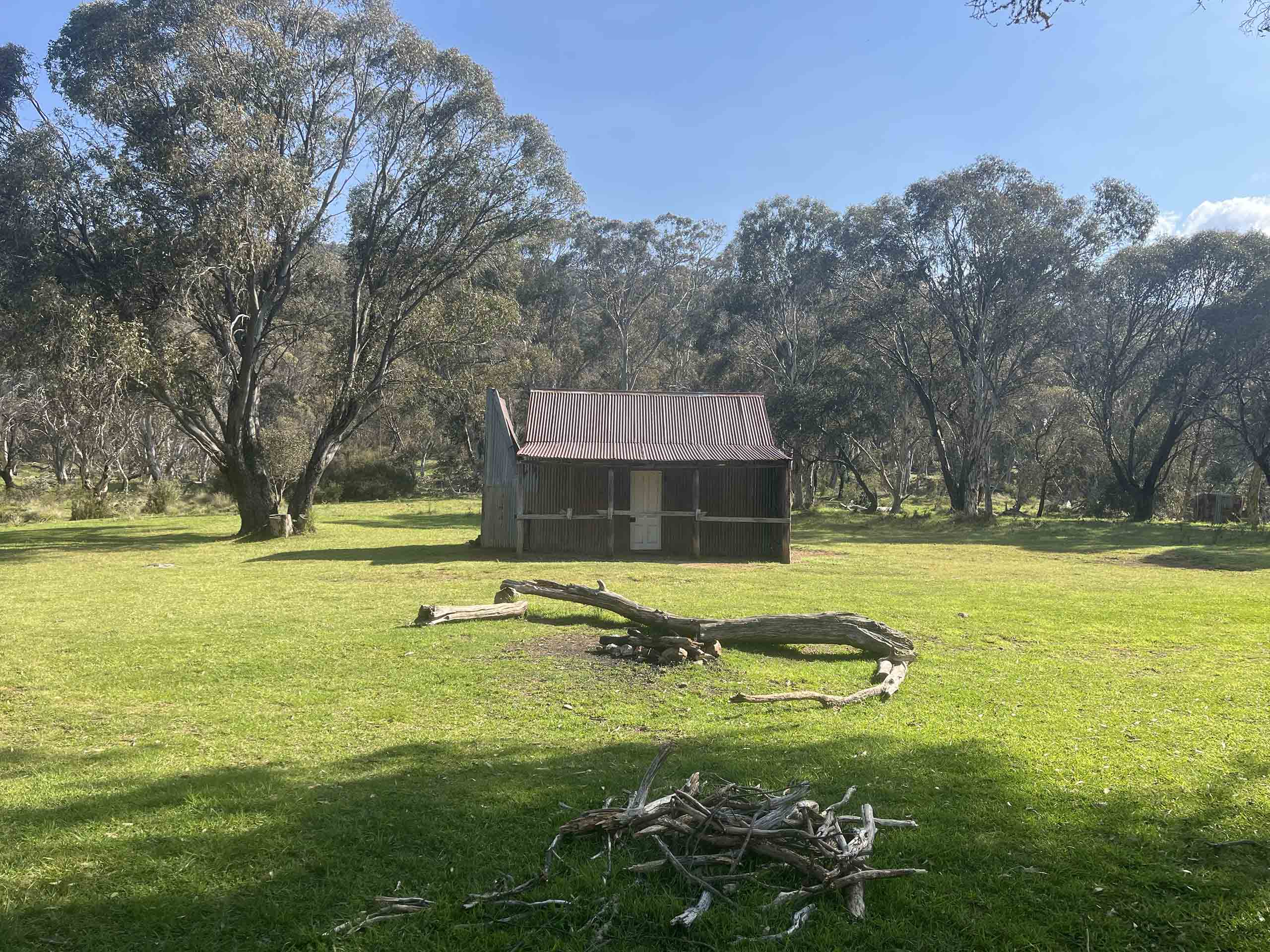
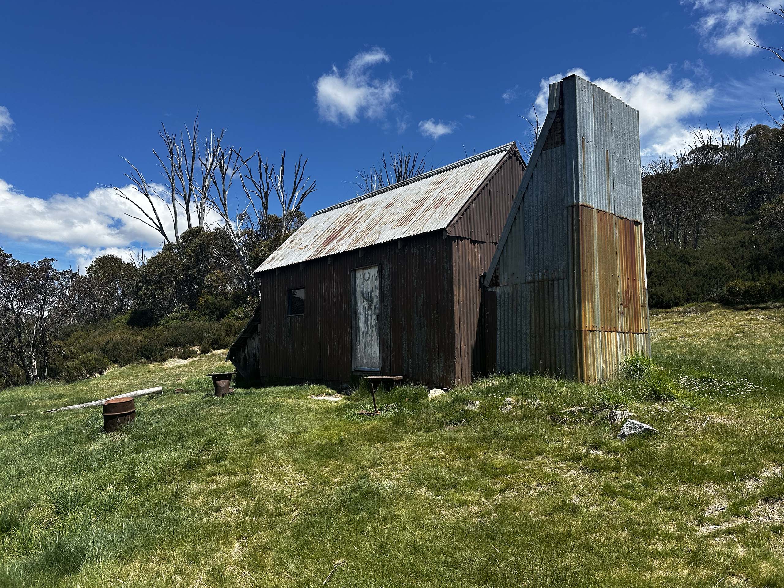
Over the next few days, we continue our trek through Namadgi National Park. A combination of single track and fire roads lead us through Bimberi Wilderness and past Mt Bimberi, the highest point in the ACT. We cross into NSW and pass Oldfields Hut, the first of many historic alpine huts we visit throughout the tour. Following fire roads through vast, open terrain, we reach Blue Waterholes and meet our support vehicle. Have the option to spend the rest of the day exploring limestone gorges, waterfalls and caves in the region, or put your feet up for a relaxing afternoon.
Popular side trips:
- Mt Bimberi (6km return)
Elevation Profile
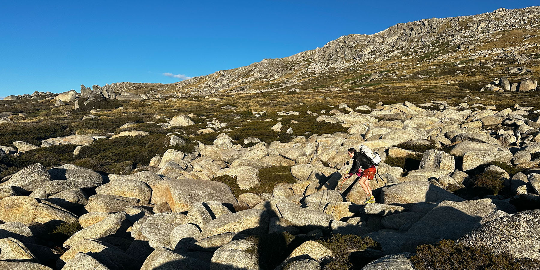
Days 5-7: Blue Waterholes – Kiandra, ~20km per day
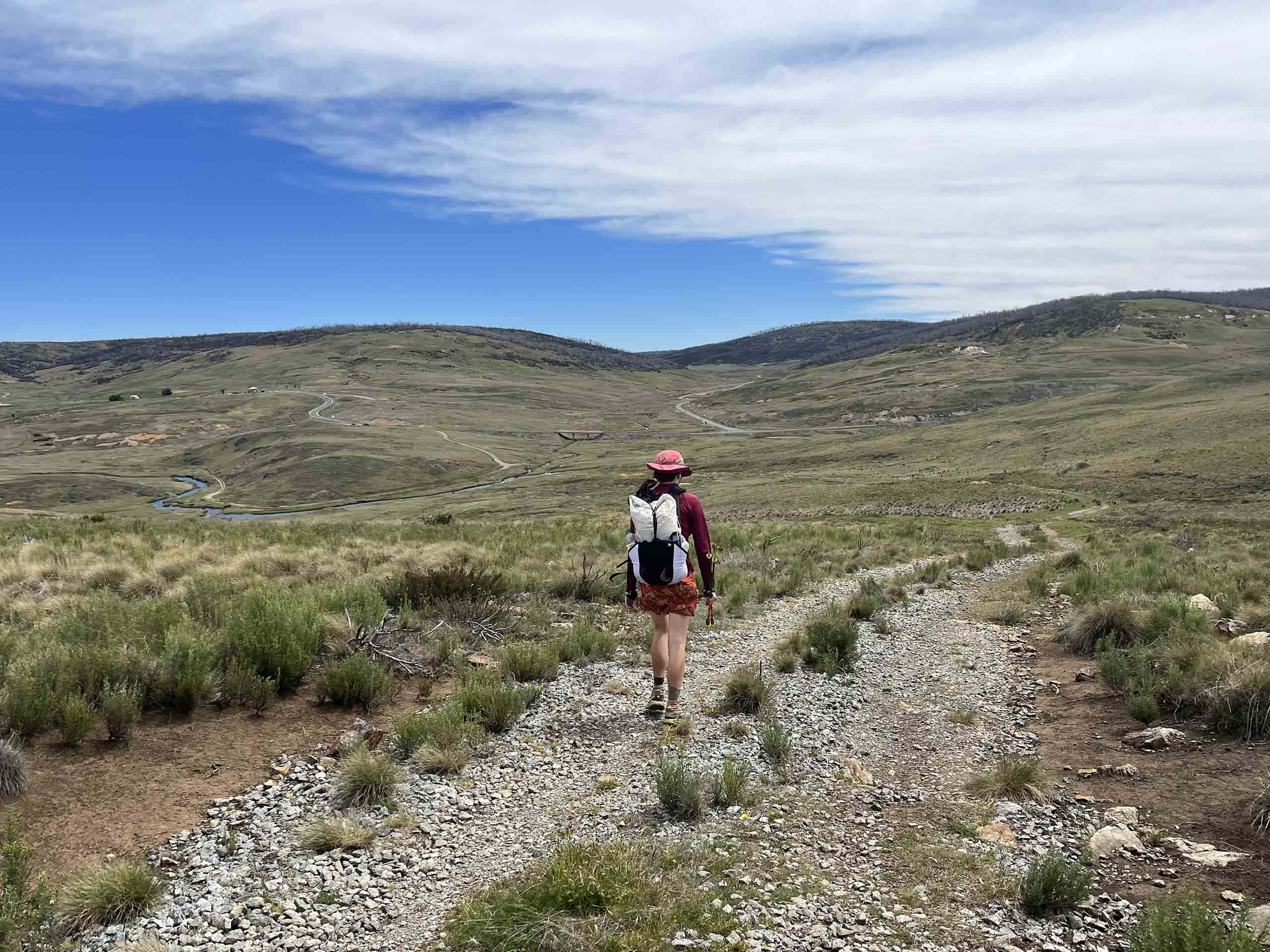
Departing Blue Waterholes, we continue our trek along open fire roads. Here, we will have the opportunity to take some short detours to visit many historic huts and homesteads in the region. Transitioning off trail, we make our way through rolling, grassy tussock fields. This is a great opportunity to practice your navigational skills if desired. After crossing the Murrumbidgee River, we follow fire roads and single track all the way to the historic gold mining town of Kiandra.
Popular side trips:
- Bill Jones Hut (2km return)
- Old Currango Homestead (3km return)
- Hainsworth Hut (0.5km return)
- Millers Hut (2km return)
Elevation Profile
Days 8-11: Kiandra – Whites River Hut, ~18.5km per day
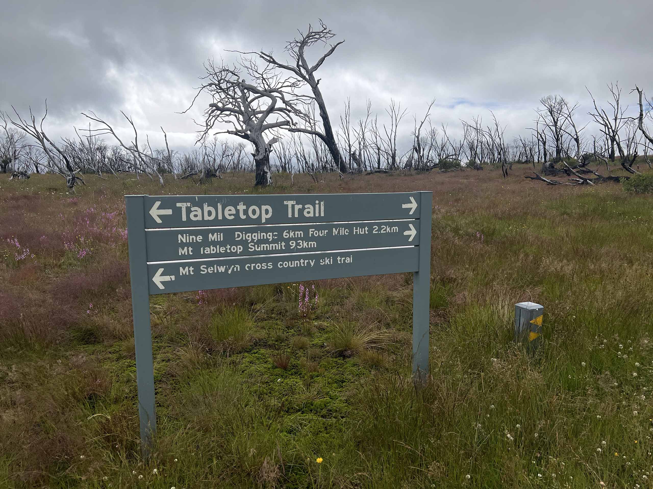
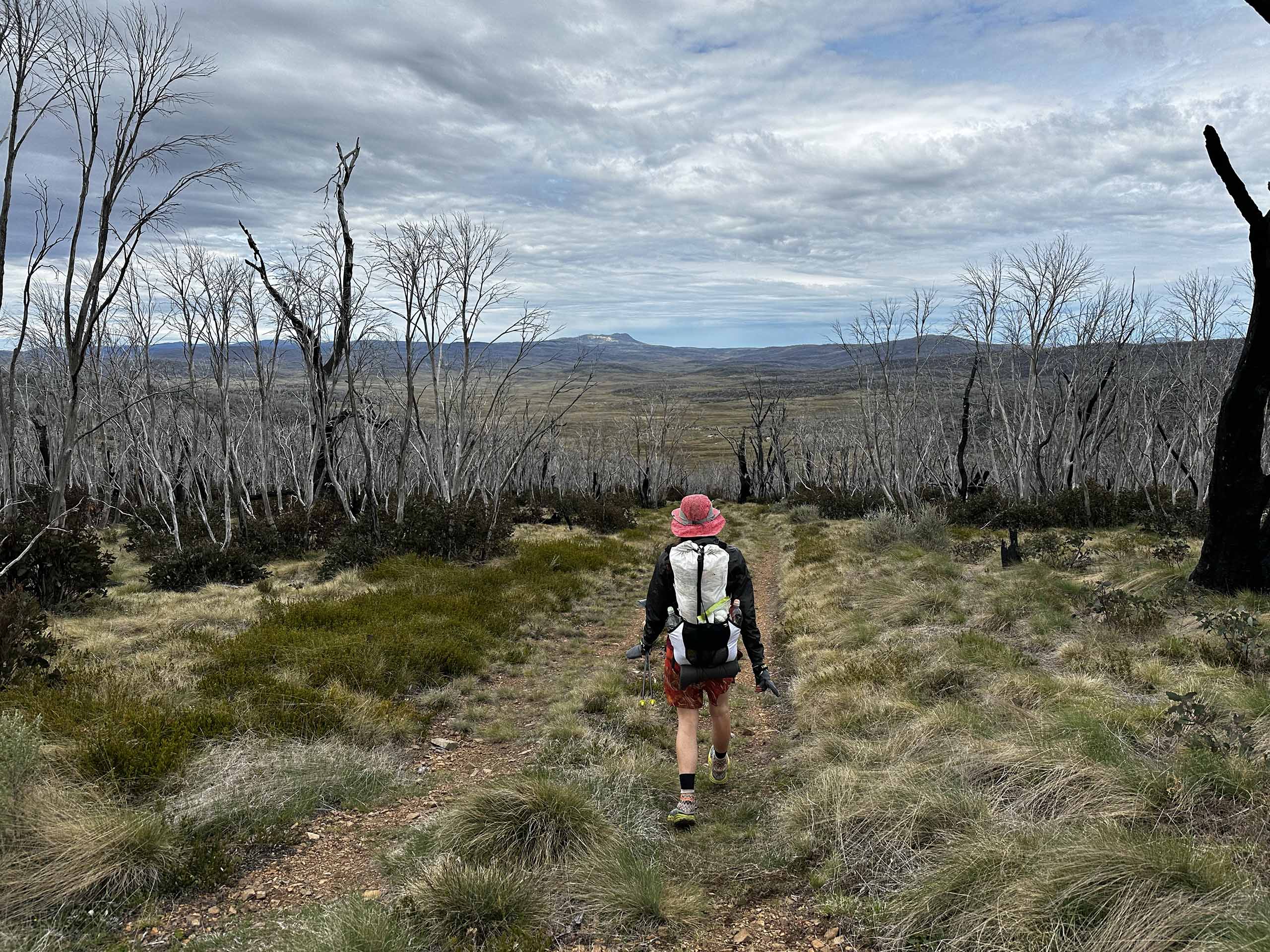
Crossing our second and final sealed road of the tour, we enter the heart of Australia’s high country. Passing many more historic huts, we travel along grassy, open fire roads and take in the extensive views of the surrounding Snowy Mountains. The well-formed track makes for quick progress, providing ample opportunity to explore some of the most remote side trips of the tour. This includes summiting Mt Jagungal and visiting the head of Valentine Falls. Alternatively, relax at the campsite and enjoy the tranquility of Jagungal Wilderness.
Popular side trips:
- Tabletop Mountain (1.3km return)
- Mt Jagungal (5.2km return)
- Valentine Falls (0.8km return)
Elevation Profile
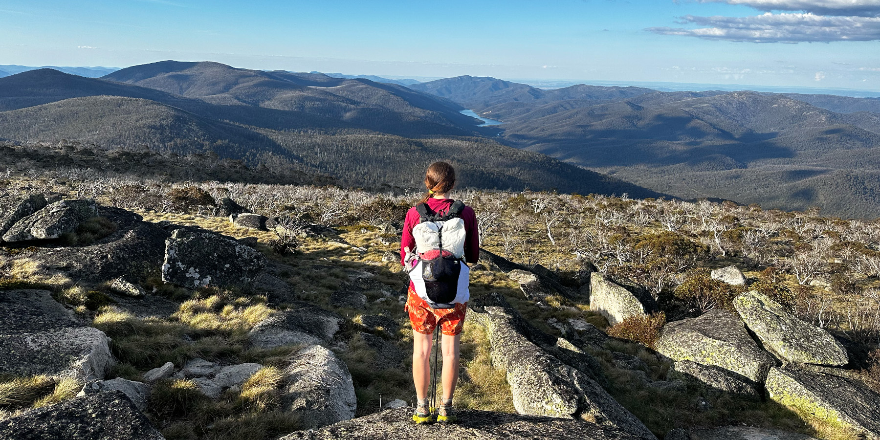
Days 12-14: Whites River Hut - Dead Horse Gap, ~13km per day
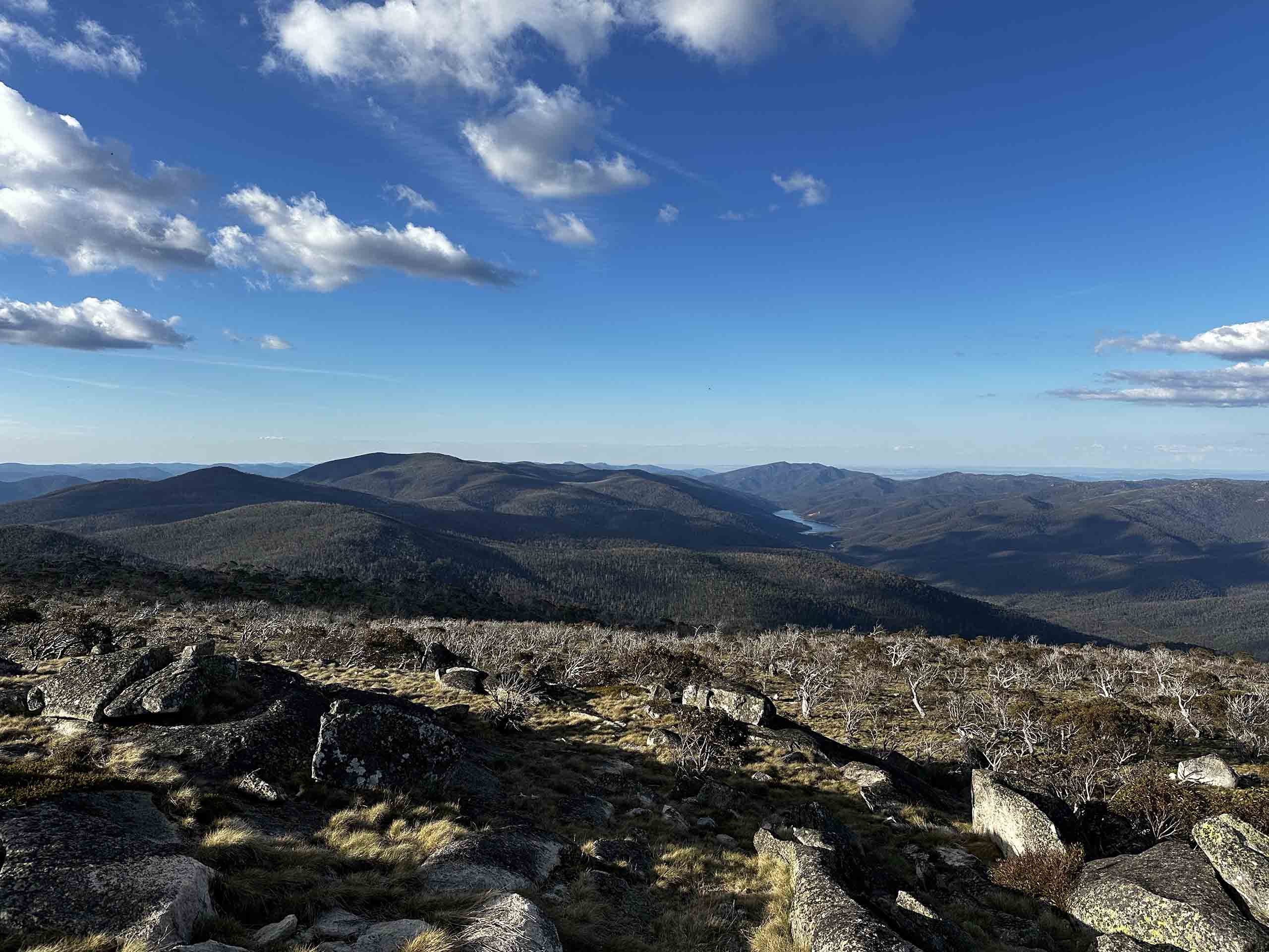
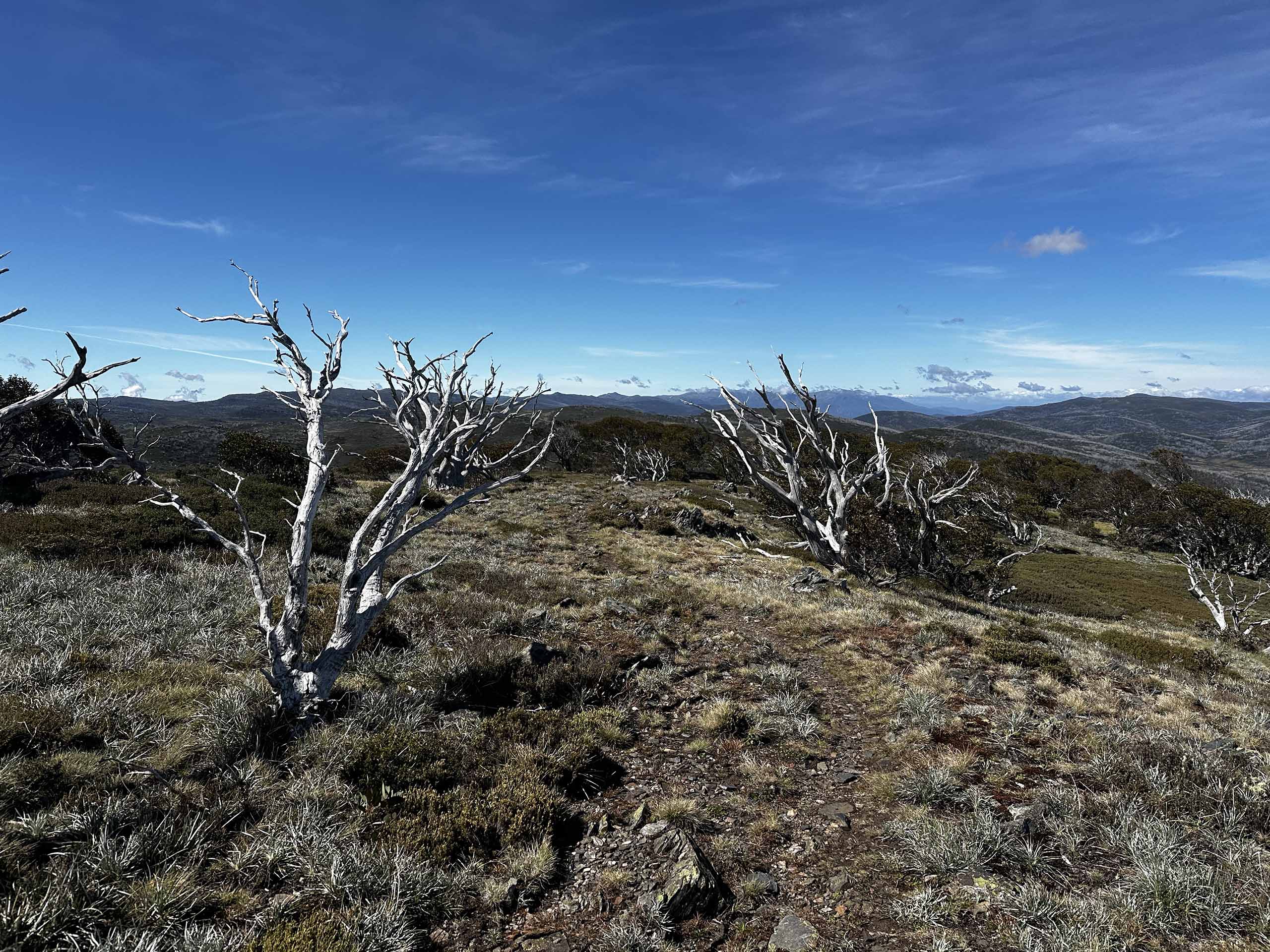
Climbing up onto the Main Range, we traverse the Rolling Grounds and explore the pristine alpine environment of Kosciuszko National Park. On these final days of the trip, we pass Australia’s highest alpine lakes including Lake Cootapatamba, Club Lake, Blue Lake, and Lake Albina. This section offers the widest range of available side trips throughout the tour. This includes the option to summit Mt Kosciuszko, the highest point in Australia. Ending our trek at Dead Horse Gap, we head into Jindabyne for some hot food and drive back to Canberra.
Popular side trips:
- The Sentinel (3.3km return)
- Blue Lake (3km return)
- Mt Townsend (5km return)
- Mt Kosciuszko (2km return
Elevation Profile
Please note that the listed itinerary is a guide. Due to many circumstances including those beyond our control (e.g. weather, park closures etc.), the route may need to be altered and/or side trips not offered.
Inclusions
- Modern hiking gear including tents, sleeping bags, packs, mats and trekking poles (plus a bunch of our other favourite little goodies). We estimate you can hike comfortably with a total pack weight under 10kg for nearly the entire trip.
- Quality, nutritious meals for the entire trip (excluding breakfast on the first day). This includes snacks and hot drinks.
- Two world-class guides.
- Transport from and to Canberra at the beginning and end of the trek.
- Access to a support vehicle every 3-4 days to resupply food and access your personal drop bag.
- Detailed pre-tour preparation package tailored to the AAWT.
- A digital map of virtual reality 360 photos and videos taken on the trip (see example below).
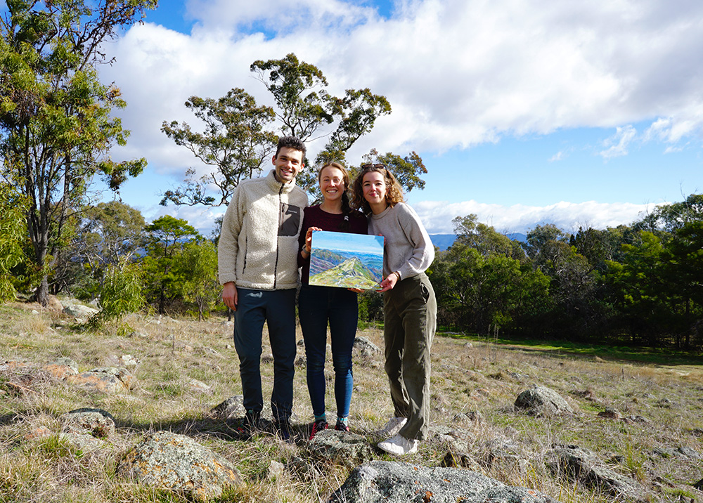
Personalised Commission Painting
Commemorate your journey with us with a personalised commission painting by local Canberra artist, Ineka Voigt. Ineka offers all TAG participants 20% off their first painting. You can find out more about this offer here.

The Adventure Gene, Ineka Voigt 2024. Oil on canvas board, 30cm x 40cm. The Sentinel, Kosciuszko National Park.
Tour Dates
| TRIP DATES | AVAILABILITY | PRICE | SPACE LEFT | |
|---|---|---|---|---|
| January 5, 2025 - January 18, 2025 | Limited | $6,495.00 |
5 Available | |
| March 16, 2025 - March 29, 2025 | Limited | $6,495.00 |
6 Available | |
| October 5, 2025 - October 18, 2025 | Limited | $6,495.00 |
5 Available | |
| November 9, 2025 - November 22, 2025 | Limited | $6,495.00 |
6 Available |
Other Information
Preparation Package
This tour includes an extensive preparation package filled with gear suggestions and techniques designed to help you thrive in the Australian Alps. Additionally, you will receive a detailed trip itinerary 8 weeks before the trip starts.
Contact
We encourage you to reach out and ask questions at any time. You can contact us via email (contact@theadventuregene.com), social media or through the website.
Insurance Coverage
All participants are required to have adequate travel insurance that covers the following:
- Medical evacuation by air, land, or sea. Please note that any evacuation deemed necessary by the guides will be the financial responsibility of the guest.
- Potential losses, damages, or injuries, including cancellation costs and loss of luggage.
Note that The Adventure Gene’s cancellation fees apply and cannot be waived.
FAQs
What level of fitness and experience is required for this tour?
Previous hiking and camping experience is not required. Our guides are experts and can teach you everything you need to know. Additionally, we provide you with all the information you need to prepare for the trip. However, it is essential that you have the required level of fitness and a willingness to learn.
You need the fitness required to carry a ~10kg pack for extended periods of time and for multiple days in a row. This includes walking off-trail and up and down steep terrain.
We recommend that all participants engage in regular weekly aerobic activity 3+ times per week. This could include activities such as hiking, cycling, swimming, running, or a team sport with lots of activity (e.g. soccer, AFL, rugby, basketball). Walking on flat concrete paths is not adequate preparation for this trip.
How difficult is this trip?
For a multiday hike with camping, we rate this tour as moderate to challenging. You can see the distance and elevation details in the table below:
| Average | Minimum | Maximum | |
|---|---|---|---|
| Distance (km) | 16.6 | 10 | 22 |
| Elevation gain (m) | 500 | 200 | 885 |
How much weight will I need to carry?
We estimate that you will be able to keep your pack weight below 10kg for nearly the entire trek. Gear provided will equate to 3.5-4kg. This leaves clothing, personal items, food and water making up the rest of the weight.
Food:
All food carries are 3 days or less, with the exception of one 5 day food carry in the second half of the trip. For the shorter resupplies, this equates to roughly 2.5kg of food per person. For the longer food carry, each person will initially have to carry up to 4.5kg of food.
Water:
Whilst water is generally readily available in this region, it is highly dependent on recent rainfall. It is uncommon to carry more than 2L of water, and the longest water carry for this trek could be up to 22km.
Do you cater for dietary requirements?
We are experienced in catering for a wide range of dietary requirements, provided you let us know in advance. If we are unable to cater for your dietary needs, we will contact you and find an alternative solution.
What type of meals do you provide?
All meals, snacks and hot drinks are provided, excluding breakfast on the first day. Breakfast and dinners are hot meals, cooked and enjoyed whilst relaxing at camp. Lunches and snacks will be eaten during breaks throughout the day. All food is designed as part of our nutrition program to ensure high energy levels for the duration of the trip.
The following are some examples of our favourite trail meals and snacks.
Breakfast:
- Trail oats with mixed nuts, dried fruit, chia seeds and maple syrup.
- A breakfast burrito with scrambled eggs, bacon, refried beans, spinach, cheese and tomato sauce wrapped in a soft tortilla.
- Buckwheat pancakes with Nutella, dried fruit and nuts.
Lunch:
- A backcountry charcuterie board! Consisting of a selection of cheeses, crackers, cured meats and hummus.
- Pitta pockets filled with olives, sundried tomatoes, cheddar, spinach and cured meat.
- Creamy pumpkin soup with sourdough bread.
Dinner:
- Trail-made gnocchi in a tomato and herb sauce.
- Cumin, lentil and apricot dahl.
- Nachos; refried beans, corn, avocado and cheese served on crispy corn chips.
What should I pack for the tour?
After your place on the tour is confirmed, you will be sent a detailed packing list of required clothing and personal items. We also provide tailored recommendations based on our 30,000+km of experience!
If you are unsure what to pack, make sure to reach out and ask questions at any time.
Do I need to share a tent?
We have both one person and two person tents available. Whilst we recommend sharing a tent to reduce pack weight, it is not a requirement. If you choose to use a one person tent, this will equate to carrying roughly an extra 325g.
How often will I get to talk to my family?
Telstra provides the best mobile phone coverage on the AAWT. Whilst not always guaranteed, we have found that we have had service at some point almost every day along the tour (most consistently at high points and mountain passes). Please note that the reception may not always be good enough to hold a phone conversation, however text messages will generally send with time.
Additionally, both guides will be carrying devices with inReach satellite technology to always have an open line of communication.
What kind of terrain will we be hiking on?
The Australian Alps Walking Track offers a diverse range of terrains and track qualities. We will spend time walking along well-formed tracks, as well as navigating off trail. Hikers will experience steep ascents and descents, river crossings and trekking through uneven terrain.
Are there age restrictions for this tour?
All participants must be over the age of 18. Participants over the age of 65 require medical clearance from their doctor to partake in this tour.
Why do I need to get my gear checked the day before the tour starts?
The entire group will meet in Canberra the afternoon before the tour starts. We will issue your gear and perform a mandatory final gear check. All participants must attend. This is a safety measure to ensure everyone is carrying the appropriate gear for the remote, alpine environments we will encounter.
Do I need travel insurance?
All participants are required to have adequate travel insurance that covers the following:
- Medical evacuation by air, land, or sea. Please note that any evacuation deemed necessary by the guides will be the financial responsibility of the guest.
- Potential losses, damages, or injuries, including cancellation costs and loss of luggage.
Note that The Adventure Gene’s cancellation fees apply and cannot be waived.
What is your cancellation policy?
You may change your trip start date, or transfer to another trip, if you notify us more than 90 days before departure.
If you wish to cancel your trip and cannot transfer to another trip, we will charge the following per person:
- 60-90 days before departure: 25% of trip price
- 30-59 days before departure: 50% of trip price
- 15-29 days before departure: 75% of trip price
- 14 days or less before departure: 100% of trip price
No refunds will be given for unused services after the trip starts. Full payment is required 90 days before trip departure. If payment is not received by the due date, we reserve the right to cancel your booking.
For more information about the AAWT, please see our AAWT Track Guide. Alternatively, feel free to send us a message and we will be able to help you out!