
Snowies Alpine Walk Track Guide (2025)
The summary
The Snowies Alpine Walk traverses 56km of some of the finest high country on mainland Australia. The track links together the popular Main Range Walking Track and Porcupine Walk with newly built trails joining Guthega, Perisher and Bullocks Flat. Hikers visit alpine lakes, summit Australia’s tallest mountains, walk through snow gum canopies and traverse open tussock fields. Located in NSW, the Snowies Alpine walk is a fantastic way to explore the Aussie Alps on well-established trails.
Contents
When to walk
The best time to walk the Snowies Alpine Walk is from late October to early April. Water is more abundant in spring, but colder temperatures and frequent rainfall are common. Additionally, there may still be some snow up on the Main Range.
On the other hand, hiking later in summer often brings better weather, but some water sources may be dry and the lack of shade makes sun exposure a more significant hazard.
Track difficulty (pros and cons)
Things that could make the track easier or more enjoyable
The trail winds through some of the most breathtaking alpine landscapes on mainland Australia.
The track is well maintained and of high quality. There are long sections of boardwalks to protect the fragile alpine ecosystem (note: this could be considered a con for some people).
Some sections of the track are quite popular and see a large number of visitors almost every day (note: this could be considered a con for some people).
The track passes through a range of landscapes, including both alpine and sub-alpine ecosystems. In spring, there are wildflowers.
- There are many options for side trips, including Mt Townsend, Mt Twynam, Blue Lake and Mt Kosciuszko.
Things that could make the track more difficult or less enjoyable
Alpine weather can be unpredictable, with the possibility of extremely high winds (100+km/hr) and snowstorms even in summer.
There aren’t many facilities, including drop toilets. This means that you need to carry out your waste (see Leave No Trace for more information).
There are lots of camping restrictions.
There aren’t many cheap transport options.
Snowpack can last all through spring and into early summer.
The trail can get quite busy during popular times, especially the Main Range Walking Track.
Cost
Depending on how you walk decide the Snowies Alpine Walk, the cost can vary significantly.
Camping:
For those camping along the trail, the total cost can range from roughly $200 to $1000. The main costs to consider include:
Food: $75 – $150. This depends on how much and what type of food you eat.
Transport: $100 – $600. This could be in the form of petrol costs for driving to/from the trail. Alternatively, you could look at getting a shuttle from/to Jindabyne. For more information on transport options, see Transport.
Parks Permit: $17 – $190. For those who are using their own vehicle, you will need a Parks Permit to enter Kosciuszko National Park. Prices can range from anywhere between $17 for a day pass to $190 for an annual pass.
You also need to factor in additional costs such as extra gear that you might need to purchase before the hike.
Accommodated:
For those doing the trail as a collection of day walks and staying in Jindabyne/Perisher overnight, the total cost can vary from roughly $1000 to $2500. the main costs to consider include:
Food: $75 – $250. This depends on how much you eat, what type of food you eat and how frequently you go out for meals in Jindabyne.
Accomodation: $100-$400 per night. For more information on, see Accomodation.
Transport: $100 – $1000. This could be in the form of petrol costs for driving to/from the trail every day. Alternatively, you could look at getting shuttles from Jindabyne. For more information on transport options, see Transport.
Parks Permit: $17 – $190. For those who are using their own vehicle, you will need a Parks Permit to enter Kosciuszko National Park.
Gear
A normal three season gear list appropriate down to -5°C is suitable for the Snowies Alpine Walk between late October and early April. Although if you get unlucky it can certainly get colder than that. Our Snowies Alpine Walk gear list is generally the same as what we would take on the Australian Alps Walking Track. You can find our gear list here.
Section distance and elevation stats
The Snowies Alpine Walk is roughly 56km long. The track has an average elevation change of 6.2%. Therefore, on average, there is ~31m uphill and ~31m downhill per km. This is moderately steep for a hike in Australia. This becomes evident when compared to other popular walks.
Comparing the steepness and distance of famous hikes
| Walk | Distance (km) | Elevation Change (%) | Location |
|---|---|---|---|
| Snowies Alpine Walk | 56 | 6.2 | Australia (NSW) |
| Bibbulmun Track | 947 | 4.5 | Australia (WA) |
| Cape to Cape Track | 126 | 3.8 | Australia (WA) |
| Larapinta Trail | 221.8 | 4.9 | Australia (NT) |
| Heysen Trail | 1077 | 4 | Australia (SA) |
| Australian Alps Walking Track (AAWT) | 680 | 8.2 | Australia (VIC, NSW, ACT) |
| Six Foot Track | 44 | 7 | Australia (NSW) |
| Great North Walk | 268 | 5.3 | Australia (NSW) |
| Great Ocean Walk | 96 | 6.2 | Australia (VIC) |
| Great South West Walk | 252.9 | 3.3 | Australia (VIC) |
| South Coast Track | 73.4 | 7.8 | Australia (TAS) |
| Overland Track (no side trips) | 71 | 5.9 | Australia (TAS) |
| Western Arthurs (full loop) | 76.1 | 11.2 | Australia (TAS) |
| Three Capes Track | 39.5 | 8.2 | Australia (TAS) |
| Te Araroa | 3000 | 4.4 | New Zealand |
| Pacific Crest Trail | 4265 | 6.6 | USA (CA, OR, WA) |
| Appalachian Trail | 3364 | 7.8 | USA (East Coast) |
Sections of the Snowies Alpine Walk
The Snowies Alpine Walk is typically broken down into four sections. Below, we outline each section and its relative steepness.
| Section | Distance (km) | Elevation Change (%) |
|---|---|---|
| Guthega to Charlotte Pass | 8.3km | 4.4 |
| Main Range Loop | 22km | 5.6 |
| Charlotte Pass to Perisher | 14km | 6.2 |
| Perisher to Bullocks Flat | 11.4 | 7.2 |
Guthega to Charlotte Pass
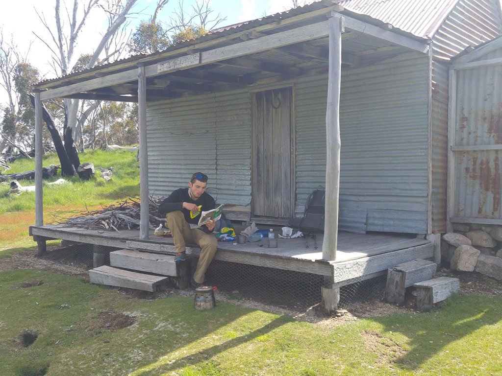
The Snowies Alpine Walk starts at Guthega, a small ski resort village. The track parallels the Snowy River, passing the Illawong Swing Bridge, as it climbs up towards the Main Range. The trail consists primarily of boardwalk and single track.
Main Range Loop
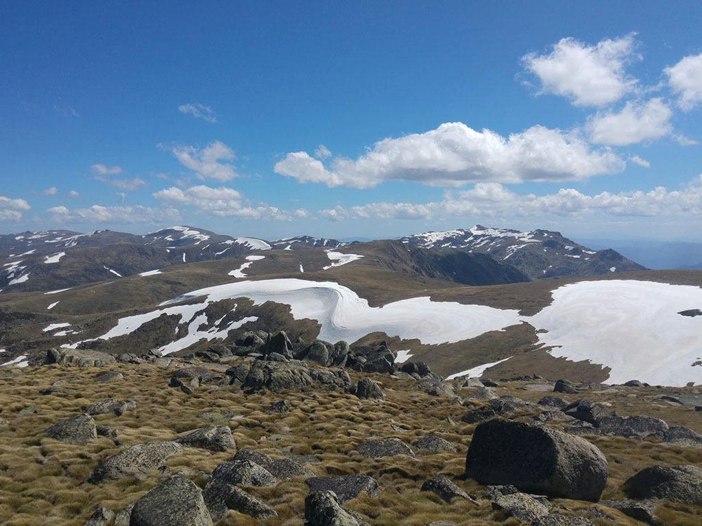
This is the most famous part of the Snowies Alpine Walk. The Main Range Loop is frequently visited by day walkers looking to summit Mt Kosciuszko. The trail is a combination of gravel road, metal boardwalk and rocky single track. There are various popular side trips including Blue Lake, Mt Townsend and Mt Kosciuszko.
Charlotte Pass to Perisher
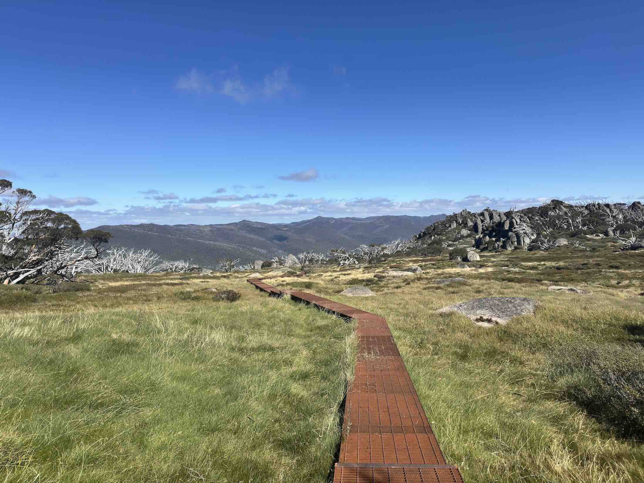
From Charlotte Pass, the Snowies Alpine Walk descends down to Charlotte Pass Ski Village. The track weaves through open valleys before climbing up to Porcupine Rocks. These collections of granite tors offer views towards Lake Crackenback and Thredbo Valley. The trail is primarily single track, with some metal boardwalk and bridges over streams.
Perisher to Bullocks Flat
The final section of the Snowies Alpine Walk goes from Perisher down to Bullocks Flat. Passing through sub-alpine terrain, the track is less exposed than other sections of the Main Range. As with previous sections of the Snowies Alpine Walk, the trail consists of primarily gravel single track with some metal boardwalk over streams and fragile areas.
Camping
Due to the fragile alpine ecosystem, as well as the high number of visitors, there are quite a few camping restrictions for the Snowies Alpine Walk. You are not allowed to camp in the following areas:
- Alpine lake catchments (including Lake Albina, Blue Lake, Club Lake, Lake Cootapatamba, and Hedley Tarn)
- Drinking water catchments for ski resorts
- Pipers Creek, Stilwell Creek Rock Creek or Blue Cow Creek catchments
- Within 30m of running water or lakes
- Within 200m of the following:
- Charlotte Pass
- Crackenback Chairlift
- Guthega Village
- Guthega Power Station
- Rawson Pass
- Mount Kosciuszko summit
- Where the Main Range walk crosses the Snowy River at Foremans Crossing
- Crackenback Chairlift to Mount Kosciuszko walkway
- Any public road except designated walk-in campsites
For more information on camping restrictions, visit the NSW Parks website.
Places to camp on the Snowies Alpine Walk
Despite the camping restrictions, there are some great options for camping on the Snowies Alpine Walk. Due to the exposed nature of the area, it is important to ensure that your campsites are sheltered wherever possible. Below is a list of possible campsites along the trail. To view these campsites on a map, see Navigation.
| Campsite | Distance from Guthega (km) | Water | Notes |
|---|---|---|---|
| Illawong Lodge | 2.3 | Y | |
| Snowy River 200m upstream from Foremans Crossing | 9.6 | Y | At the bottom of the steep descent from Charlotte Pass. You must be at least 200m away from the crossing to adhere to camping restrictions. |
| Mt Townsend Saddle | 19.6 (+2km detour) | Depends on recent rainfall | Semi-sheltered. Wouldn't be good in bad weather. |
| Wilkinsons Creek | 19.8 | Y | |
| Trapyard Creek | 35.8 | Y | |
| Johnnies Hill | 36.4 | N | |
| Near Betts Creek | 40.2 | Can be found 0.5-1km downhill. |
Our Recommended Schedule/Campsites
Based on the above campsites, here is our recommendation on how to hike the trail over 4 days.
Day 1: Guthega to Charlotte Pass (8.95km) → camping 200+m upstream from Foremans Crossing
Day 2: Charlotte Pass to Wilkinsons Creek (11.25km)
Day 3: Wilkinsons Creek to Trapyard Creek (16.5km)
Day 4: Trapyard Creek to Bullocks Flat (19.45km)
Accomodation Options
There are many options for accomodation around Jindabyne to suite various price points. The Jindabyne Holiday Park has simple cabins for a little as $100 per night. For those looking for something nicer, there are various motels, chalets and Airbnb options.
It is important to book accomodation early as places can book out months in advance over the summer season.
Transport
There are two ways most hikers approach transport for the Snowies Alpine Walk.
Car shuffle
A popular approach to transport for the Snowies Alpine Walk is car shuffles. This means that you leave one car at the end of the track, before driving over to the start. Once you finish your hike, you drive back to the start of the trail to collect the other car. This approach can be used by both hikers intending to camp out on the trail, as well as those doing day walks and staying in Jindabyne.
The benefits of this approach is that it is cheap. The downsides include more driving and needing to have access to two cars. For solo hikers, this option isn’t feasible.
Shuttles
Another common option for hikers is to use shuttles to/from Jindabyne. This approach is used by both campers and day walkers staying overnight in Jindabyne.
For hikers camping up on the trail, who just need a lift to the start and pickup from the finish, this could be a good option to avoid having to shuffle cars. However, if you require daily transfers to/from the trail because you are staying in Jindabyne overnight, this could get expensive quickly.
Commonly used shuttles include:
To get an idea of pricing, you will need to contact the companies to get quote for the transfers you need. Prices are typically in the range of several hundred dollars.
Other options
Other options for transport include hitching or paying a local to give you a lift. Posting on the Jindabyne Facebook page notice board is a great way to get in contact with locals and see if anyone is able to help you out.
If you are hitching, know that Guthega has very low car traffic and be prepared to wait a while. On the other hand, Bullocks Flat is easier to get a hitch to/from.
Guided Hikes on the snows alpine walk
There are several options for guided trips along the Snowies Alpine Walk. These are a great option for those who would rather not deal with the logistics behind the trail (e.g. transport, Park permits, accomodation, gear etc.).
Camping Trips
Currently, we are the only tour company offering a camping based experience on the Snowies Alpine Walk. We complete the trail over 4 days, camping at our favourite campsites along the track. All hiking gear, food and transport is provided. You just need to show up with your clothes! You can find more information about these trips here. Alternatively, feel free to send us a message.
Accommodated Trips
There are a few companies offering accommodated guided trips along the Snowies Alpine Walk. These trips range from 4 to 6 days. On these trips, you complete the trail as a collection of day walks, staying in Jindabyne overnight. Examples of companies running these trips include Women Embrace Adventure and Australian Walking Holidays.
Facilities
Most facilities for the Snowies Alpine Walk are located in Jindabyne or Perisher. In Jindabyne, there is a Woolworths, several outdoor gear shops, and various restaurants/cafes. Perisher has similar options but is generally more expensive.
On the trail itself, there are very few facilities for hikers. Toilets are located at Guthega, Charlotte Pass, Rawson Pass, Perisher and Bullocks Flat. The Rawson Pass toilet is the only toilet that is not located at a trailhead. Due to the lack of toilets, it is important that all hikers carry out their waste. To learn more, see Leave No Trace.
Leave No Trace
The Snowies Alpine Walk passes through fragile alpine ecosystems. Additionally, the area sees a high number of visitors each week. Because of this, leave no trace principles are really important for hikers on the trail. This includes but is not limited to:
- Carrying out your waste
- Carrying out all rubbish (including food scraps)
- Camping on durable surfaces
- Minimising soap usage
For more information on leave no trace, you can check out our article on Practice Methods to Reduce Your Environmental Footprint Whilst Hiking. To learn how we like to carry out our waste, you can read A Comprehensive Guide To Carrying Our Your Waste Whilst Hiking.
Water availability
There is generally good water availability along the Snowies Alpine Walk. Water will be more readily available in Spring, with some sources drying up over Summer and into Autumn. Below, we list reliable water sources for the trail. There is likely to be more water available than what is listed here. To view these water sources on a map, see Navigation. Additionally, we highly recommend you treat all water sources.
| Water | Distance from Guthega (km) |
|---|---|
| Spencers Creek | 3.2 |
| Snowy River | 9.5 |
| Carruthers Creek | 12.5 |
| Wilkinsons Creek | 19.8 |
| Snowy River | 26.9 |
| Spencers Creek | 32.3 |
| Wrights Creek | 33.2 |
| Trapyard Creek | 35.5 |
| Tributary to Thredbo River | 39.1 |
| Rock Creek | 45.8 |
| Thredbo River | 56.2 |
Navigation
There are several ways to navigate the Snowies Alpine Walk. Our preferred method is using a smartphone with GPX files. A variety of GPX files can be found online and imported into mapping apps such as Gaia, MapOut, and CalTopo. We primarily use MapOut and Gaia for navigation, while also uploading the GPX files to our inReach Mini as an emergency backup in case our phones fail.
FarOut is currently developing its Snowies Alpine Walk map, which will be a valuable tool in the future.
Alternative navigation options include handheld GPS devices or paper maps.
You can download our GPX file for the trail here (non-commercial use only).
Mobile phone reception
Telstra offers the best coverage in the NSW high country. On the Snowies Alpine Walk, we have found that we had service daily, particularly at higher elevations and mountain passes. In some cases, Optus had coverage where Telstra did not. For those seeking the best possible reception, carrying two SIMs—one physical and one eSIM (if supported by your phone)—could be a worthwhile option.


