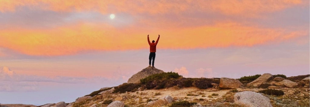
Trek Through Namadgi: A Land of Granite Tors & Towering Eucalypts
Situated in the Australian Capital Territory (ACT), Namadgi National Park is the smallest of the three primary parks comprising the Australian Alps, yet it covers 46% of the ACT’s total land. The park’s high national status stems from its legislative protection, which prioritises nature conservation above all other land uses. A significant portion of the park was first reserved in 1908 as the ACT was developed, mainly to protect the water catchment for Canberra.
Granite Peaks and Alpine Plains
Namadgi’s terrain is defined by long, parallel, folded ridges separated by high valleys. Extending north from the Kosciuszko massif, these long mountain ridges are deeply cut by the wide valleys of the Cotter, Paddys, Gudgenby, and Naas rivers. The roads within the park generally follow these ridge lines or valley floors.
As the highest range in Namadgi, the Brindabella Range marks the park’s western and southern boundary, which also serves as the state border. Notable geological and landscape features include:

Granite Outcrops and Ridges
The long ridges consist mainly of granite, exposed after erosion stripped away the overlying sedimentary rock. Granite tors, a feature typical of the Kosciuszko region, also appear in parts of the Brindabellas and the Scabby Range.

High Shallow Valleys
These include examples such as Grassy Creek, Naas, Gudgenby, Rendezvous, and Orroral valleys.

Alpine Areas
While Namadgi’s elevations are generally lower than Kosciuszko’s, a treeline is just visible on the bare summit of Bimberi Peak (1,913 m). Mount Murray (1,845 m) and Gingera (1,857 m) are other significant peaks located within or on the park’s boundary.
Wildlife and Vegetation
Namadgi is exceptionally biodiverse, with 700 confirmed species of vascular plants. Its high-mountain zones nurture many rare, endangered, and endemic plant and animal species. This environment, considered one of Australia’s most precious natural assets, is characterized by a specialized mosaic of high-altitude habitats. Among these is the unique Alpine Sphagnum Bogs and Associated Fens, which is nationally listed as a threatened ecological system.
Flora
The plant life in Namadgi significantly overlaps with that of the broader high country; approximately 80% of its species are also found in at least one of the other two main Australian Alps parks. Namadgi’s vegetation is generally determined by altitude.
Mountain Forests
At lower elevations (around 1,000m ascending the Brindabellas), Alpine Ash (Eucalyptus delegatensis) is present, forming a distinct band just below the snow gums. Dense, wet forests on the mountain slopes are dominated by mixed eucalypt species, including blue gums (E. globulus) and peppermints (E. radiata and E. dives).
Subalpine Zone
The landscape changes to Snow Gum woodland (E. pauciflora) above roughly 1,500 m.
Wetlands
The well-known Ginini Flats contains an alpine bog dominated by sphagnum moss, recognized as one of Australia’s largest and best-preserved examples.
Fauna
Namadgi is a critical conservation area, preserving essential habitats thanks to its zero-tolerance policy on feral horses. This policy has successfully protected the last refuge for several native species.
Northern Corroboree Frog (Pseudophryne pengilleyi)
The park is an essential refuge for the northern corroboree frog, found only in the high montane and subalpine zones of Namadgi and Kosciuszko. These frogs require specialized sphagnum bogs to breed, a limited habitat that is easily destroyed by trampling, fire, or vehicles.
Mammals
Eastern Grey Kangaroos are common, resting in large mobs during the day and browsing in the morning and evening. Wombats and echidnas are also frequently seen. The subalpine zone hosts nocturnal specialists like the broad-toothed rat and the mountain pygmy-possum, which are seldom spotted.
Birds and Reptiles
In the open alpine zone, short vegetation allows for easy viewing of birds like lyrebirds, noisy miners, and wedge-tailed eagles. The region’s reptiles include snakes and a rich variety of skinks, with 11 alpine species present.
Historical Significance and Indigenous Connections
Indigenous Heritage
The park’s name, Namadgi, is the Aboriginal name for the Brindabella Range. Archaeological evidence confirms that Aboriginal people have been actively using the Namadgi high country for nearly 8,000 years.
The Yankee Hat Ngunnawal Site, accessible via a recommended short walk, is a major cultural highlight. Its rock art shelter powerfully evokes the Ngunnawal presence, overlooking a landscape of rich grassland, swamp, and wooded slopes. The art illustrates important animals and resources, including the goanna, snake, kangaroo, dingo, tortoise, and Bogong moth.
To provide further historical context, the drive into the Brindabellas via routes like the Tidbinbilla–Paddys River Road follows an ancient pathway once used by Traditional Owners. Furthermore, the neighboring Tidbinbilla Nature Reserve is home to Birrigai, acknowledged as the region’s oldest known Aboriginal site.
European Settlement and Industrial History

Pastoral Legacy
The first significant European use of the mountains was for pastoralism, mirroring early land use in the ACT region. Grazing occurred in the shallow subalpine valleys of the Naas, Gudgenby, and Orroral rivers. Today, visitors can still find historic sites, such as the ruins of Lone Pine Homestead and the locations of Westermans and Brayshaws Homesteads.

Mining as a Pathway
Although mining was never a major industry within Namadgi, the area was part of the wider Australian Alps mining history. It served as a travel corridor for gold prospectors on their way to major goldfields, such as Kiandra in New South Wales.
Weather and Seasonality
Being an alpine and sub-alpine park, Namadgi has four distinct seasons and notoriously unpredictable weather. Conditions can vary from hot, dry days in summer to complete snow cover in winter, with frost possible at any time of the year.
Temperature graph
Below is the average temperature for this region, where the shaded area highlights the range expected 80% of the time.
Best Time for Walking
The most reliable and pleasant time for hiking in Namadgi is autumn (March to May). This season generally provides stable weather, clear sunny days, crisp air, and cool nights, creating perfect walking conditions. Late spring (late October to November) is another excellent option, as the weather settles and the landscape bursts with wildflowers. Summer is also popular, but hikers must be ready for high temperatures and potential thunderstorms. Winter hiking offers quieter trails, though hikers must be equipped for snow and freezing conditions.
Browse all Namadgi Tours
- Hiking
- 16 days
- From $7,495
+ 3 other dates