Summary
The Larapinta Trail is one of Australia’s iconic long distance walks. Located in Australia’s Northern Territory (NT), it stretches 230km from Alice Springs in the east to Mt Sonder in the west. The trail winds along Tjoritja, or the West MacDonnell Ranges, traversing outback landscapes and ridgelines. Whilst it is known for its dry and hot conditions, the track is well-maintained, with reliable water tanks and other useful facilities at its campsites.
When to walk
The ideal time to hike the Larapinta Trail is between April and September, where the cooler months provide more comfortable hiking conditions. It’s highly recommended to avoid walking from October to March as temperatures regularly soar above 40°C.
Autumn
Autumn (April to May) in the NT sees maximum temperatures in the mid-high 20’s. Rain is scarce and the West MacDonnell Ranges turn into a vibrant landscape, filled with wildflowers like the Senna bush and Mulla Mulla. Bird activity also peaks, especially in the park’s western areas. You may be able to spot Major Mitchell’s cockatoos and wood swallows. Large flocks of budgies and finches are also more common this time of year.
Winter
Winter (June to August) brings chilly temperatures with a top of ~20°C during the day. Whilst daytime conditions are manageable, in the evening, temperatures occasionally drop below 0°C, especially in the valleys. Like Autumn, rain is scarce.
Spring
Spring (September) is typically the wildflower season on the Larapinta Trail, providing you with more flowers in bloom compared to Autumn. If you hike during early spring, you’ll likely encounter fewer people on the trail compared to earlier months. Temperatures in September can reach up to the mid-high 20’s. Increasing temperatures can give rise to the odd thunderstorm, however the monthly rainfall is no greater than in previous months.
Which Direction to Walk
You can walk the track either from west to east (W2E) or east to west (E2W), with both options offering a similar level of difficulty. Each direction has its own advantages, depending on your preferences and logistical considerations.
West to East (W2E)
This direction starts at the Redbank Gorge trailhead, with the hike finishing at the Telegraph Station in Alice Springs. Its primary advantage is the logistical convenience of finishing near a town. If you can hitch or arrange a lift to the trailhead at Redbank Gorge to begin your hike, you don’t have to worry about transport at the end of your trip.
Additionally, one of the benefits of W2E is that in the afternoon, during the hottest part of the day, the sun will be behind you rather than in your face.
East to West (E2W)
E2W begins at the Telegraph Station in Alice Springs and finishes at Redbank Gorge. One of the attractions of walking this direction is that you can finish your trip by summiting Mt Sonder, the highest point on the trail.
However, there are logistical considerations to keep in mind. Transportation at the end of your trip from Redbank Gorge to Alice Springs must be booked in advance, as finding transport on-site can be difficult. Hitchhiking is also an option but highly depends on the time of day and how busy the road is. If you are planning on hitching, we recommend starting at 12pm at the latest.
Getting to the start and finish
Getting to Alice Springs
There are many ways you can get to Alice Springs. Most Australian cities provide direct flights to and from Alice Springs Airport, with flights from Darwin or Adelaide taking ~2hr via Qantas or Virgin.
You can also drive to Alice Springs. Whilst it is a long drive and not everyone’s cup of tea, the trip does offer the chance to visit other rural towns and attractions in the outback (such as Ularu, Kings Canyon and Lake Eyre). When we first hiked the Larapinta Trail in 2019, we drove to Alice Springs from Canberra via the Oodnadatta Track. This was a great way for us to extend the trip and get a sense of scale of the Australian outback.
Bus services such as Greyhound Pioneer and McCafferty’s are available from Darwin or Adelaide. It usually takes ~21hr from Darwin and ~20hr from Adelaide.
Getting to/from the Redbank Gorge trailhead
Once in Alice Springs, you will need to arrange transport to/from the Redbank Gorge trailhead (depending on which direction you walk). There are no public transportation services available to or from the area. It is only accessible by 4WD on a dirt road, although, you can reach the turn-off to Redbank Gorge via Namatjira Drive using a 2WD on a sealed road. Hitching is possible, however it is generally easier to catch a ride back to Alice Springs rather than to get to Redbank Gorge (good for walkers going E2W). The drive time is ~2hr.
Another option is to book private transport services. You can contact Larapinta Trail Transfers & Transport (LTTS), Outback Elite Tours, or Larapinta Express to travel to and from most trailheads, intermediate points, and other locations along the track in the Tjoritja/West MacDonnell National Park. LTTS, in particular, offers transportation to remote areas, like Mt Zeil and other locations across the ranges.
Track difficulty (pros and cons)
The Larapinta track can be considered as a moderate to difficult hike. It has 12 sections, each varying in difficulty.
Things that could make the track easier or more enjoyable
- Iconic Australian outback scenery.
- Mt Sonder and other high points of the trail offer great views.
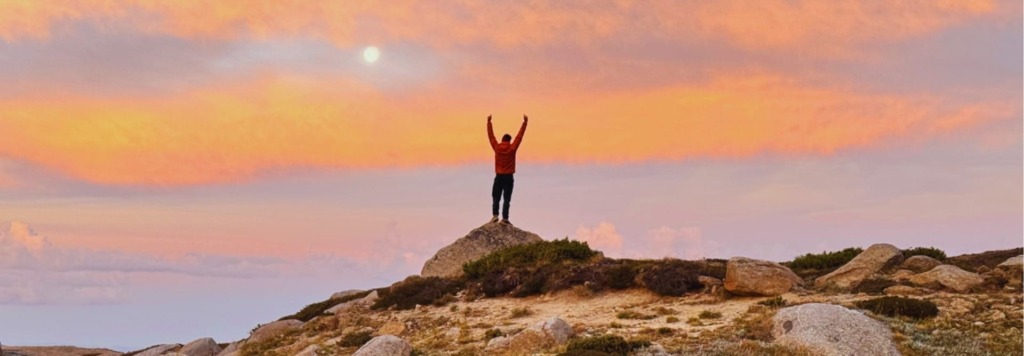
- Spectacular sunrises and sunsets.
- Excellent ridgeline walking
- Well-maintained track
- There’s a very low chance of rain or cloud cover.
Things that could make the track more difficult or less enjoyable
- Apart from Alice Springs, there are very few places to buy food along the trail.
- The track can become extremely hot, with minimal share and sparse vegetation.
- Most of the sections are rocky – some consist mainly of boulders and loose rock.
- The track can get quite busy, with numerous walkers and tourist groups.
- The booking system can be cumbersome and limiting.
Permits
Since April 2023, a permit is required to hike the Larapinta Trail. All permits for are issued online, through the Northern Territory Parks Booking System. To access the trail, hikers are required to also get a parks pass.
When booking a multi-day walking trip, you will need to:
- Select the trail, including the start date, the number of nights, and the number of people in your group.
- Choose a campground for each night of your walk.
- Complete the reservation by filling out the occupant details.
You can make reservations up to 12 months in advance. Once your booking is complete, you will receive a confirmation email containing your booking confirmation, relevant park information, and your camping tag. According to park rules, you must have your camping tag with you during your hike, either as a printed copy or saved on your phone.
We find that this permit system can cause a lot of pre-planning stress. It’s important to remember that the booked campsites represent your ‘intended trip’. If you need to walk less distance on a given day for safety reasons (e.g. blisters, heat, stomach problems, injury), then it is totally acceptable to cut your day short and camp early. You aren’t then expected to pull big kilometres to catch back up to your schedule either.
Being set on reaching your designated campsite has caused many problems on trails with systems like this. Always remember that there is enough flexibility in the system to allow for changes in itinerary and your safety and health is the top priority.
Cost
Overall, the hike can cost roughly $1000 – $2000 per person (excluding gear). This price is assuming a 10 day walk (9 campsites, 10 days of food), accommodation in Alice Springs before and after the trip, placing 3 food drops, transport to/from Redbank Gorge and getting to Alice Spings to start your hike. Here’s a breakdown of potential expenses:
Accomodation
Accomodation in Alice Springs typically ranges from $90 – $130 for motels, and $130 – $200 for hotels, guesthouses and some B&Bs.
Campsites along the track must be booked in advance. All campsites have a fee of $10 per adult, with the exception of Standley Chasm which has a fee of ~$20. For more details on these campsites, you can head over to the Campsites section.
Food
We spent approximately $30 per person each day for groceries. For a 10-day hike, a reasonable food estimate would be around $300. If you factor in additional items such as fuel, blister kits, and other essentials, your supplies could total closer to $500.
As for food drop services, costs vary depending on the provider. LTTS charges $100–$110 per 50L container, whilst Outback Elite’s prices range from $95–$120 per food from. Larapinta Express offers a 55L container for $85.
Transport
Getting to Alice Springs can take a large part of your budget. Bus fares from Darwin or Adelaide to Alice Springs can range from $200-$400. However, if you prefer flying, round-trip plane tickets usually start at around $700.
As mentioned earlier, transportation from Alice Springs to the trailhead at Redbank Gorge can be arranged through local operators. LTTS offers transfers for $220, whilst Larapinta Express charges $360. These fees also apply for return transfers.
Gear
A standard three-season hiking gear is generally recommended. Whilst rainfall is rare, nighttime temperatures often drop below 0°C, so warm clothing is still essential. Additionally, many campsites have spiky thorns, making it practical to carry a lightweight foam mat, such as the Neve Gear 1/8″ Ultralight Foam Pad (96g). Not only does it protect your inflatable sleeping mat, but it can also double as a sit pad. We also encourage packing a head net as it can provide much-needed relief from flies, especially during the hotter parts of the day.
A reliable water purification system is crucial for this trail. That’s because there are frequent reports of hikers getting sick after drinking untreated water from the trail’s water tanks. Filtering your water is essential to avoid this risk.
Some of the campsites, such the one at Ormiston Gorge, have USB charging points or power outlets. As such, it can also be useful to bring a wall charger. This largely negates the usefulness of a solar panel (despite the weather conditions being optimal for solar power).
Lastly, sun protection on this trail is very important! There is very little natural shade and heat exhaustion is a common issue. With that in mind, a sun umbrella is an excellent way to stay protected. Currently, our top pick is the Hyperlite Mountain Gear Essential Umbrella (~190g), which features a split vent in the canopy for added stability. For a lighter and more compact option, the Montbell Travel Umbrella UV 50 (~130g) is a great alternative.
We will be adding a detailed list of our recommended gear to this guide soon. Click here to subscribe to our newsletter and be notified. In the mean time, we recommend taking a look at our Bibbulmun Track gear lists.
Section distance and elevation stats
The Larapinta trail spans 230km with an average gradient of 6.1%. The total elevation gain/loss is 7079m/7180m. Hiking 20km per day would mean an average elevation gain of 610m per day.
This is how the Larapinta Trails compares to other renowned tracks in terms of steepness:
Comparing the steepness and distance of famous hikes
| Walk | Distance (km) | Elevation Change (%) | Location |
|---|---|---|---|
| Bibbulmun Track | 947 | 4.5 | Australia (WA) |
| Cape to Cape Track | 126 | 3.8 | Australia (WA) |
| Larapinta Trail | 221.8 | 4.9 | Australia (NT) |
| Heysen Trail | 1077 | 4 | Australia (SA) |
| Australian Alps Walking Track (AAWT) | 680 | 8.2 | Australia (VIC, NSW, ACT) |
| Six Foot Track | 44 | 7 | Australia (NSW) |
| Great North Walk | 268 | 5.3 | Australia (NSW) |
| Great Ocean Walk | 96 | 6.2 | Australia (VIC) |
| Great South West Walk | 252.9 | 3.3 | Australia (VIC) |
| South Coast Track | 73.4 | 7.8 | Australia (TAS) |
| Overland Track (no side trips) | 71 | 5.9 | Australia (TAS) |
| Western Arthurs (full loop) | 76.1 | 11.2 | Australia (TAS) |
| Three Capes Track | 39.5 | 8.2 | Australia (TAS) |
| Te Araroa | 3000 | 4.4 | New Zealand |
| Pacific Crest Trail | 4265 | 6.6 | USA (CA, OR, WA) |
| Appalachian Trail | 3364 | 7.8 | USA (East Coast) |
Comparing the distance and average elevation change for each section
The Larapinta Trail is split into 12 distinct sections. From west to east, we’ve listed each section below, paired with distance and average gradient based on our GPS measurements.
| Sections (W2E) | Distance (km) | Steepness (%) |
|---|---|---|
| Redbank Gorge – Mt Sonder | 14.6 | 11.6 |
| Redbank Gorge – Finke River | 26.2 | 6.9 |
| Finke River – Ormiston Gorge | 9.1 | 6.4 |
| Ormiston Gorge – Serpentine Chalet Dam | 29.2 | 6.2 |
| Serpentine Chalet Dam – Serpentine Gorge | 13.0 | 6.6 |
| Serpentine Gorge – Ellery Creek | 13.3 | 6.4 |
| Ellery Creek – Hugh Gorge | 29.1 | 6.0 |
| Hugh Gorge – 4/5 Junction | 15.3 | 6.3 |
| 4/5 Junction – Standley Chasm | 16.9 | 6.5 |
| Standley Chasm – Jay Creek | 13.8 | 6.6 |
| Jay Creek – Simpsons Gap | 25.8 | 6.3 | Simpsons Gap – Telegraph Station | 24.6 | 6.2 |
Resupply
For those doing the Larapinta self guided, there are three ways to resupply along the trail. Below, we explain how you can replenish your food and other essential items during your hike.
Resupply locations
Alice Springs has major supermarkets such as Coles and Woolworths for general grocery shopping. However, in Alice Springs outdoor and camping supplies are limited. Lone Dingo stocks general hiking supplies, but don’t expect a wide variety of items.
Outside of Alice Springs, resupply options are extremely limited. Along the trail, there are small stores at:
- Ormiston Gorge (49.8km)
- Standley Chasm (170.4km)
These are great opportunities to purchase a cold drink or ice cream. However, we wouldn’t recommend doing a full resupply at these places.
Note that Discovery Parks at Glen Helen, the primary accommodation provider at Glen Helen Gorge, is no longer a resupply point, as it has been closed since July 2023.
Resupplying via food drops
If you are placing your food drops yourself, common locations include:
- Ormiston Gorge (50.0km)
- Serpentine Gorge (93.5km)
- Ellery Creek South (107.0km)
- Standley Chasm (167.1km)
The first three locations can be accessed by getting a key from the visitor centre in Alice Springs. You will need to pay a $10 fee as well as a $50 deposit that will be refunded once the key is returned.
To use the storage at Standley Chasm, you need to contact them as they it is privately owned.
Your food drops will need to be labeled with your name, the date and your intended pick-up date. You must collect your food drops before returning the key.
Using food drop services
If you prefer not to handle your food drops yourself, there is the option to use local operators. The same companies providing transportation services, like LTTS and Larapinta Express can also arrange food drops and pickups.
LTTS delivers food drops to all official storage points, with prices ranging from $100 to $110 for a 50L container. They also accommodate food drops to the Standley Chasm facility for an additional $5 drop fee. Larapinta Express provides a 55L supply container for $85 each.
Campsites
The Larapinta Trail features 26 designated camping sites, as well as one private campground. Camping fees apply to all sites. Some sites offer basic facilities, such as shelters and toilets (generally drop toilets but some sites have flush toilets). No campsites permit campfires.
To access the campsites, you have to book for each night of your trip.
- Visit nt.gov.au.
- Click on Walking Trail.
- Select Larapinta Trail and enter your start date, number of nights, number of people and direction.
- Select campsites for each night of your trip.
- Put in your details and pay the fees.
Note: Standley Chasm is a private campsite and booked separately.
List of campsites
| Campsites (W2E) | Distance from last (km) | Water tank Y/N | Limited capacity? | Notes |
|---|---|---|---|---|
| Redbank | 0 | Yes | Toilet available and USB charging | |
| Rocky Bar Gap | 10.8 | Yes | Toilet available | |
| Hill Top | 5.0 | No | 3-4 tents | |
| Finke River | 10.3 | Yes | 3-4 tents | Toilet available and USB charging |
| George Creek | 7.7 | No | ||
| Ormiston Gorge | 1.4 | Yes | Tourist spot with kiosk | |
| Mt Giles Lookout | 14.5 | No | 3 tents | |
| Waterfall Gorge | 2.0 | No | 4-6 tents | |
| Serpentine Chalet Dam | 12.7 | Yes | 5-6 tents | Toilet available and USB charging |
| Counts Point | 6.3 | No | 2 tents | |
| Serpentine Gorge | 7.7 | Yes | 4-5 tents | Toilet available and USB charging |
| Ellery Creek South | 12.4 | Yes | Toilet available | |
| (Ellery Creek North) | (13.3) | (Yes) | (On alternate. Toilets available and USB charging) | Rocky Gully | 14.4 | Yes | 5-6 tents | Toilet available | Ghost Gum Flat | 7.9 | No | 3-4 tents | Hugh Gorge Campsite | 6.9 | Yes | Toilet available and USB charging | Hugh Gorge Junction | 3.7 | No | 2-3 tents | Fringe Lily Creek | 3.8 | No | 4/5 Junction | 7.8 | Yes | Toilet available and USB charging | Stuart's Pass | 3.6 | No | Brinkley Bluff Summit | 3.6 | No | Standley Chasm | 9.9 | Yes | Tourist spot with kiosk. Private campsite. | Millers Flat | 5.0 | No | 3-4 tents | Jay Creek | 8.4 | Yes | Toilet available | Mulga Camp | 9.8 | Yes | Toilet available | Simpsons Gap | 15.7 | Yes | Toilet available | Wallaby Gap | 11.1 | Yes | 4-5 tents | Toilet available |
Suggested Itinararies
Here we list some recommended itineraries for the Larapinta Trail. All itineraries include summiting Mt Sonder on Day 1.
8 days (~28.8km/day)
Redbank → Rocky Bar Gap, including Mt Sonder summit (25.4km) → Ormiston Gorge (24.4km) → Counts Point (35.5km) → Rocky Gully (34.5km) → 4/5 Junction (30.1km) → Jay Creek (30.5km) → Simpsons Gap (25.5km) → Telegraph Station (25.0km)
9 days (~25.6km/day)
Redbank → Rocky Bar Gap including Mt Sonder summit (25.4km) → Ormiston Gorge (24.4km) → Serpentine Chalet Dam (29.2km) → Ellery Creek South (26.4km) → Ghost Gum Flat (22.3km) → Stuart’s Pass (25.8km) → Jay Creek (26.9km) → Simpsons Gap (25.5km) → Telegraph Station (25.0km)
10 days (~23km/day)
Redbank → Redbank, including Mt Sonder summit (14.6km) → Finke River (26.1km) → Waterfall Gorge (25.6km) → Serpentine Gorge (26.7km) → Rocky Gully (26.8km) → Fringe Lily Creek (22.3km) → Standley Chasm (24.9km) → Mulga Camp (23.2km) → Wallaby Gap (26.8km) → Telegraph Station (13.9km)
11 days (~20.9km/day)
Redbank → Redbank, including Mt Sonder summit (14.6km) → Finke River (26.1km) → Mt Giles Lookout (23.6km) → Counts Point (21.0km) → Ellery Creek South (20.1km) → Ghost Gum Flat (22.3km) → 4/5 Junction (22.2km) → Millers Flat (22.1km) → Mulga Camp (18.2km) → Wallaby Gap (26.8km) → Telegraph Station (13.9km)
12 days (~19.2km/day)
Redbank → Redbank, including Mt Sonder summit (14.6km) → Hill Top (15.8km) → Ormiston Gorge (19.4km) → Waterfall Gorge (16.5km) → Counts Point (19.0km) → Ellery Creek South (20.1km) → Ghost Gum Flat (22.3km) → 4/5 Junction (22.2km) → Millers Flat (22.1km) → Mulga Camop (18.2) → Wallaby Gap (26.8km) → Telegraph Station (13.9km)
13 days (~17.7km/day)
Redbank → Redbank, including Mt Sonder summit (14.6km) → Hill Top (15.8km) → Ormiston gorge (19.4km) → Waterfall Gorge (16.5km) → Counts Point (19.0km) → Ellery Creek South (20.1km) → Ghost Gum Flat (22.3km) → 4/5 Junction (22.2km) → Millers Flat (22.1km) → Mulga Camp (18.2) → Simpsons Gap (15.7) → Wallaby Gap (11.1km) → Telegraph Station (13.9)
14 days (~16.4km/day)
Redbank → Redbank, including Mt Sonder summit (14.6km) → Hill Top (15.8km) → Ormiston Gorge (19.4km) → Waterfall Gorge (16.5km) → Counts Point (19.0km) → Ellery Creek South (20.1km) → Rocky Gully (14.4km) → Hugh Gorge Junction (18.5km) → Brinkley Bluff Summit (18.8km) → Millers Flat (14.9km) → Mulga Camp (18.2km) → Simpsons Gap (15.7km) → Wallaby Gap (11.1km) → Telegraph Station (13.9)
Water availability
The Larapinta Trail is known for its dry conditions, with the only reliable water sources being water tanks. Rainfall is generally scarce and as a result waterholes in creeks may be completely dry.
Fortunately, most campsites along the trail have water tanks or are connected to a bore reticulation system. The tanks are generally dependable, as they are regularly refilled when needed. However, campsites like Millers Flat, Waterfall Gorge, and Brinkley Bluff may have unreliable water supplies.
List of water locations (W2E)
| Section/Location | Distance W2E (km) | Distance from previous (km) |
|---|---|---|
| Redbank Gorge | 0, 14.6 | 0, 14.6 |
| Rocky Bar Gap | 25.3 | 10.7 |
| Finke River | 40.8 | 15.5 |
| Ormiston Gorge | 49.8 | 9.0 |
| Serpentine Chalet Dam | 79.0 | 29.2 |
| Serpentine Gorge, Larapinta Trail campsite | 93.9 | 14.9 |
| Ellery Creek North | 107.0 | 13.1 |
| Rocky Gully | 121.5 | 14.5 |
| Hugh Gorge | 136.3 | 14.8 |
| 4/5 Junction | 153.2 | 16.9 |
| Standley Chasm | 170.3 | 17.1 | Jay Creek | 184.0 | 13.7 | Mulga Camp | 193.5 | 9.5 | Simpsons Gap | 209.6 | 16.1 | Wallaby Gap | 220.4 | 10.8 | Alice Springs Telegraph Station | 230.0 | 13.6 |
Note that whilst some of these distances may appear short, these water carries can take longer than anticipated due to challenging terrain and/or poor track quality. For a detailed guide to the location of water sources along the track, see the Chapman & Siseman guide book. The Facebook page is also a good source of information for current water updates.
Wildlife
The Larapinta track is home to diverse flora and fauna, which offers a small glimpse of Australia wildlife. The track has about 1,500 plant species, including wildflowers, shrubs, and grasses. Acacias, mallees, and Spinifex desert grass grow in MacDonnell Ranges, whilst gum trees are abundant along major streams.
In spring, over 767 species of plants bloom in the West MacDonnell National Park. Among them are mistletoes, emu bush (desert fuchsia), Sturt’s desert rose, silver cassia, curry wattles, and white paper daisies. Shrubs like tall Mulla Mulla and yellowtails are also common.
As for fauna, over 200 bird species live in the Larapinta trail, including budgerigars, ringneck parrots, wood swallows, finches, and wedge-tailed eagles. At Simpsons Gap, you might spot the black-footed rock wallaby, one of the region’s most recognisable animals.
Reptiles and amphibians are also part of the trail’s ecosystem, with species such as the perentie (Australia’s largest monitor lizard), geckos, Spencer’s burrowing frog, and brumbies. Larger animals include red Kangaroos, the biggest in the MacDonnell Ranges, and dingoes, which are occasionally seen in the area.
Navigation
We primarily relied on our mobile phones and GPS watches to navigate the Larapinta trail, using apps like Gaia GPS and CalTopo. These apps allow importing GPX files and downloading offline maps, so you don’t need mobile reception. They also support Strava heatmaps, which are particularly useful for evaluating track quality, especially when the route becomes less clear on rocky high ground.
For additional trail information, we recommend using FarOut for first-hand comments from hikers who have recently completed the track. This provides valuable insights into current conditions and water sources.
GPX file
Click here to download our GPX file for the trail (non-commercial use only).
Map
Mobile phone reception
Mobile phone coverage along the track is very limited and mostly depends on your carrier. Reception is typically available at high points such as Mt Sonder, Hill Top Lookout, Counts Point, Brinkley Bluff and Euro Ridge.
Attractions
Many sections of the Larapinta Trail are attractions in their own right. Here are some of the most famous.
Mount Sonder
With a height of 1,380m, Mt Sonder, or Rwetyepme, is the highest point on the Larapinta trail and the fourth-highest peak in the Northern Territory. It is a prominent landmark along the track.
Ormiston Gorge
This area showcases unique geological formations and landforms, along with a near-permanent waterhole at its southern end, which is estimated to be up to 14m deep.
Ochre Pits
These pits are an Aboriginal heritage site and the only ochre quarry in Central Australia accessible to visitors. The rich colours of the mineral have been extracted by local Aboriginal people for generations.
Counts Point
Counts Point offers one of the best lookouts on the Larapinta track, with panoramic views of Central Australia’s western horizon.
Serpentine Gorge
Serpentine Gorge has a scenic walk among river red gums. This area is often overlooked in favour of other nearby attractions.
Standley Chasm
Early mornings and late afternoons in the Standley Chasm or Angkerle Atwatye offers the best opportunity to spot wildlife, including the black-footed rock wallabies.
Simpsons Gap
Simpsons Gap is a prominent waterhole along the track. It’s surrounded by ancient ghost gums, large mulga stands, and over 40 plant species.
Euro Ridge
At 790m high, Euro Ridge gives you a great view of Alice Springs and Mt Gillen. It’s made from large granite slabs tilted at 45°, and it is also a great photo stop!
Old Telegraph Station
Established in 1872, the Alice Springs Telegraph Station Historical Reserve marks the site of the first European settlement in Central Australia. It is one of the best-preserved stations along the Overland Telegraph Line.
Useful resources
- Larapinta Trail Guidebook John and Monica Chapman
- Northern Territory Government Information and Services | Larapinta Trail
- Larapinta Trail Facebook Group
- FarOut | Larapinta Trail
- Trip report by Stephen Davies