Summary
Te Araroa is New Zealand’s national trail. At 3,000km, the trail traverses the entire length of the country, from Cape Reinga on the North Island to Bluff on the South Island. The trail takes hikers through a wide range of landscapes, including beaches, volcanic plateaus, beech forest, sprawling farmland, and the rugged alpine passes of the Southern Island. It is known for its unique birdlife, notorious mud, and constant change in trail conditions.
When to walk
The hiking season for Te Araroa is dictated by the alpine conditions and numerous unbridged rivers of the South Island. The entire trail’s timing, regardless of direction, is planned to ensure hikers are crossing the high passes—like the Richmond Range and Waiau Pass—in snow-free conditions. This is when the snowpack is likely gone and potentially fast-flowing rivers are at their lowest and safest levels to ford.
This critical South Island window determines the two main hiking plans. The vast majority of hikers choose a southbound (SOBO) route, starting at Cape Reinga on the North Island in late spring (late October to early December). This schedule allows them to complete the North Island and arrive at the South Island’s during that peak summer period. A smaller number of hikers opt for a northbound (NOBO) journey, starting at Bluff on the South Island in January. This late start ensures the southern passes are already clear of snow when they begin, allowing them to hike north and finish the trail on the North Island before winter sets in around April or May.
Getting to the start and finish
Getting to the start and from the finish of Te Araroa requires more planning than many other long trails, as both ends are in remote parts of the country.
For the northern terminus at Cape Reinga (the typical SOBO start), there is no direct public transport. Most hikers first travel to Kaitaia, the northernmost large town, via a national bus service. From Kaitaia, the most common options are to either hitchhike the remaining 110km, arrange a private lift, or book a one-way ticket on one of the large tourist buses that run day trips to the Cape.
The southern terminus at Stirling Point in Bluff (the SOBO finish) is logistically simpler. Bluff is a small port town connected to the city of Invercargill by by regular shuttles and bus services. It is also a relatively easy hitch. From the city of Invercargill, hikers have access to a domestic airport and bus connections to major transport hubs like Queenstown and Dunedin, making the journey home relatively straightforward.
Track difficulty (pros and cons)
Things that could make the track easier or more enjoyable
- Lots of native birds and wildlife.
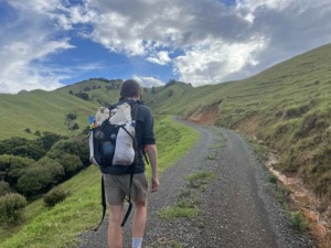
- Huge variety in scenery and terrain, including beaches, forest, mountains, farmland and walking through towns.
- World-class hut system (particularly on the South Island), which you are allowed to sleep in if you have a hut pass.
- The Whanganui River canoe is a lovely addition to the trail, offering a remote water paddle for ~150km.
Things that could make the track more difficult or less enjoyable
- Sections of trail can be very muddy.
- Extensive road walking, particularly on the North Island.
- Complex logistics, including booking canoes, transferring islands, and organising shuttles around large rivers.
- Huts can get crowded easily.
- River crossings can be challenging, particularly after heavy rainfall.
- Can be hard to find campsites on the North Island.
- Highly variable track quality and maintenance.
Gear
A 3-season gear list warm down to -5C is typical for most hikers on Te Araroa. In peak season it is quite rare to get temperatures consistently below 0C. You can see our 2.8kg gear list here from our self-supported FKT of the trail.
Wildlife
Te Araroa is unique for what’s missing: there are no native land predators. You don’t have to worry about bears, mountain lions, or venomous snakes, which creates a very different backcountry experience. The most common mammals you’ll see are actually introduced pests, like possums (which frequently raid huts and campsites at night), rats, and stoats. By far, the most impactful “wildlife” encounter is with insects. The South Island is infamous for its relentless swarms of sandflies, which can make any rest stop miserable, while wasps can be a problem in some forest sections.
The birdlife is the true wildlife highlight of the trail. Because New Zealand’s birds evolved without land-based predators, many are incredibly bold and curious. You’ll almost certainly be followed by the cheerful Pīwakawaka (fantail), which flits around your feet to catch insects you kick up. Indeed, the tiny South Island robin is famous for landing on hikers’ boots. You’ll also encounter the more mischievous native birds: the weka, a flightless bird known for stealing food and anything shiny, and the kea, the world’s only alpine parrot.
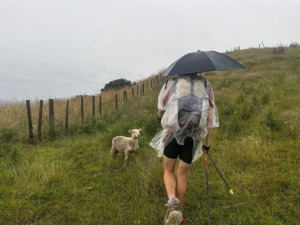
Of course, you’ll get to see plenty of sheep too. Whilst you likely won’t see a kiwi, you can make the trip to Stewart Island to try spot one after your hike.
Navigation
We navigated Te Araroa mainly with our mobile phones and GPS watches. The trail is not as well marked as other long distance hikes such as the Pacific Crest Trail and the Bibbulmun Track. It more on par with the Australian Alps Walking Track. FarOut is a useful resource, along with the Te Araroa – The Trail App and Te Araroa Notes and Map app.