Summary
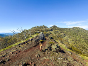
The Australian Alps Walking Track (AAWT) is a remote 680km walk between Walhalla (VIC) and Tharwa (ACT). It traverses large sections of the nicest high country on mainland Australia, including the highest point in Australia, Mount Kosciuszko. Passing through terrain that is inaccessible by vehicle, the track offers the potential to explore some of the most remote and rugged areas within Victoria, NSW, and the ACT. Although the popularity of the AAWT is increasing, the remote nature of the track means it’s possible to spend days at a time without seeing other hikers.
As is the nature of remote hikes, the AAWT requires a bit more planning than most other hiking trails within Australia. The terrain is rugged, demanding, and track quality varies wildly. There are frequent sections of slow overgrown trails, where hikers must be competent navigators and a GPS can be useful. A significant time commitment is generally required to organise, place, and collect food drops. Finding water can be tricky, and there are only three towns along the track that you can easily detour into. Additionally, in some sections there are unnecessarily long periods of firetrail walking where further track investment could improve the hiker experience.
These physical, mental, and logistical challenges form part of the character of the AAWT. Accordingly, hikers are rewarded with some of Australia’s finest alpine scenery, the opportunity to visit historic huts, many side trips to investigate, and a sense of peace and quiet that is becoming much harder to find on Australia’s other premier walking trails.
If you want to walk a long distance trail in Australia but don’t have much experience, the Larapinta Trail and Bibbulmun Track also offer excellent (different) scenery with fewer challenges and would be great preparation for the AAWT.
When to walk
The best times to walk the AAWT are from mid-spring to early autumn. Water is more readily available during spring, however colder temperatures and rain are more frequent. Conversely, walking later in summer can bring finer weather, but there is increased bushfire risk and water may be harder or impossible to find. Autumn is also possible and largely depends on recent rainfalls after summer.
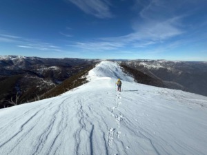
The track can also be walked during winter, but it is not common. A winter traverse is significantly harder and requires snow safety skills. Skis or snow shoes are normally needed to traverse alpine regions. Navigation is more challenging and the track is prone to harsher weather conditions. Additionally, some access roads are closed over winter, making the track more remote.
Track difficulty (pros and cons)
Things that could make the track easier or more enjoyable
- The track traverses some of the most spectacular alpine regions on mainland Australia.
- The track is remote and you typically see very few people (note that this may be considered a con for some people).
- There is an abundance of side trips and detours, allowing each walker to personalise their trip if they desire.
- Alpine huts add character and history.
- There is a comprehensive guide book.
- There is very little walking along farm land.
Things that could make the track more difficult or less enjoyable
- The track is overgrown in many places.
- The route is not always well marked and navigation can be challenging.
- The weather can be unpredictable in alpine regions (you can get snow storms in summer).
- The terrain can be very steep.
- There are lots of fire trails.
- You will likely need to place food drops (this requires both the time to place them, as well as time to collect them after you have finished).
- There is no public transport to the southern terminus, Walhalla.
Cost
Compared to other walks, the AAWT is relatively cheap. This is because there are only two towns near the track, so it is difficult to splurge on accommodation and food in town. Aside from purchasing hiking gear, the primary costs associated with walking the AAWT are buying and placing the food drops, and accommodation along the way.
- Food: $350-$400 pp. This will depend on how fast you walk and much food you plan to eat each day. This estimate comes from Maddie’s plan to walk the track in approx. 25 days, with roughly 800g of food per day. This cost also includes extra food placed in the drops as a buffer and other miscellaneous items like sunscreen.
- Car fuel: $300-$400. This will depend on how many food drops you plan to use, as well as the price of petrol and the fuel efficiency of your car. This estimate is based on the price we paid to place and pick up 12 food drops in January 2022.
- Accommodation: $0-$200 per night. This depends on if/where you plan to stay at either of the two towns near the track. Booking in advance can ensure you get cheaper options.
Gear
Section distance and elevation stats
The AAWT is between 650km and 690km long (depending on the source). The track has an average elevation change of 81.7m/km. Therefore, on average, there is ~41m up and ~41m down per km. This is pretty steep for a long hike in Australia. This can be seen by comparing to other popular walks:
Comparing the steepness and distance of famous hikes
| Walk | Distance (km) | Elevation Change (%) | Location |
|---|---|---|---|
| Bibbulmun Track | 947 | 4.5 | Australia (WA) |
| Cape to Cape Track | 126 | 3.8 | Australia (WA) |
| Larapinta Trail | 221.8 | 4.9 | Australia (NT) |
| Heysen Trail | 1077 | 4 | Australia (SA) |
| Australian Alps Walking Track (AAWT) | 680 | 8.2 | Australia (VIC, NSW, ACT) |
| Six Foot Track | 44 | 7 | Australia (NSW) |
| Great North Walk | 268 | 5.3 | Australia (NSW) |
| Great Ocean Walk | 96 | 6.2 | Australia (VIC) |
| Great South West Walk | 252.9 | 3.3 | Australia (VIC) |
| South Coast Track | 73.4 | 7.8 | Australia (TAS) |
| Overland Track (no side trips) | 71 | 5.9 | Australia (TAS) |
| Western Arthurs (full loop) | 76.1 | 11.2 | Australia (TAS) |
| Three Capes Track | 39.5 | 8.2 | Australia (TAS) |
| Te Araroa | 3000 | 4.4 | New Zealand |
| Pacific Crest Trail | 4265 | 6.6 | USA (CA, OR, WA) |
| Appalachian Trail | 3364 | 7.8 | USA (East Coast) |
Comparing the distance and average elevation change for each section
Additionally, there is huge variation in the difficulty of sections along the AAWT. This can be seen by comparing the distance and average elevation change for each section:
| Section | Distance (km) | Elevation Change (%) |
|---|---|---|
| Walhalla – Mt Victor | 79.1 | 8.5 |
| Mt Victor – Rumpff Saddle | 35.2 | 9.6 |
| Rumpff Saddle – Mt Hotham | 127.1 | 11.5 |
| Mt Hotham – Omeo Highway | 73.6 | 8.2 |
| Omeo Highway – Benambra-Corryong Road | 28.5 | 9.7 |
| Benambra-Corryong Road – Dead Horse Gap | 120.4 | 7.1 |
| Dead Horse Gap – Kiandra | 114.6 | 6 |
| Kiandra – Tharwa | 107.1 | 6 |
In terms of track difficulty, the hardest parts of the AAWT are from Walhalla to Mt Hotham. After that, the track quality generally improves and progress is easier (but there are still long steep climbs). Once you cross the border from Victoria into NSW (between Benambra-Corryong Road and Dead Horse Gap), the track becomes much faster as you essentially follow flat(ish) fire trails all the way to the end!
Resupply
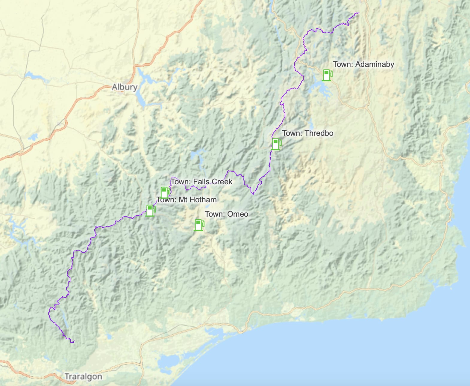
Resupplying along the AAWT can be a logistical challenge, as the trail is remote and does not pass directly through any towns. It is possible to take ~5km detours into the ski towns of Mt Hotham, Falls Creek, and Thredbo, and hitchhike 0.5-1h into the larger towns of Adaminaby and Omeo.
Given these limited resupply points, most people choose to place food drops, or have friends and family meet them with resupplies along the track. Depending on when you plan to walk, you may need to place your food drops months in advance as some roads are closed over winter.
To learn more about how to do the AAWT without placing food drops, you can check out our article here.
Recommended resupply options
We think these are the three best resupply strategies depending on your circumstances. For more detail, open the Caltopo map below where you can view the drop locations for each strategy separately.
No driving
This is our favourite option as it does not require any driving ahead of time to place food drops. However, it does require hitchhiking at Omeo Hwy and Kiandra. If you do not want to hitchhike, you can place food drops at Omeo Hwy and Kiandra which are sealed roads. Although certainly doable, we do not recommend carrying food from Walhalla to Mt Hotham as it is the hardest section of track.
- Jamieson-Licola Rd (113.2km): Pay a company to place a food parcel here for you (~$450).
- Mt Hotham (243.5km): Walk into Mt Hotham.
- Omeo Highway (317.2km): Arrange a trail angel to pick you up.
- Dead Horse Gap (466.1km): Walk into Thredbo along the Thredbo River Valley Trail.
- Kiandra (580.0km): Hitchhike into Adaminaby.
Reduce pack weight (2WD in good weather)
This option is suitable if you wish to drive to further reduce the amount of food you need to carry. From our experience, all roads are 2WD accessible in good weather. Note that road conditions vary from year to year depending on level of maintenance. It is important to be aware of current road conditions and recent rainfall.
- Stronachs Camp (48km): Place a food drop here.
- Jamieson-Licola Rd (113.2km): Place a food drop here.
- Mt Hotham (243.5km): Walk into Mt Hotham.
- Bennambra-Corryong Road (345.5km): Place a food drop here.
- Dead Horse Gap (466.1km): Either place a food drop here or walk into Thredbo along the Thredbo River Valley Track.
- Kiandra (580km): Place a food drop here or hitch into Adaminaby.
- Pocket Saddle Rd (634.4km): Place a food drop here.
Reduce pack weight (4WD)
This is the final option we recommend if you want to fully minimise the amount of food you need to carry. It requires a 4WD as some of the tracks are very rough! Once again, it is important to be aware of current road conditions and recent rainfall.
- Stronachs Camp (48km): Place a food drop here.
- Jamieson-Licola Rd (113.2km): Place a food drop here.
- Camp Creek Campground (179.0km): Place a food drop here.
- Mt Hotham (243.5km): Walk into Mt Hotham.
- Omeo Hwy (317.2km): Place a food drop here.
- Cowombat Flat Track (408.0km): Place a food drop here.
- Dead Horse Gap (466.1km): Either place a food drop here or walk into Thredbo along the Thredbo River Valley Track.
- Kiandra (580km): Place a food drop here or hitch into Adaminaby.
- Pocket Saddle Rd (634.4km): Place a food drop here.
Resupply locations
If you wish to make your own resupply schedule, we have listed many of the possible food drop locations below. Note that these distances were calculated from our 689km long GPX file (see Navigation). Open the map for more details.
Map of locations
List of locations
| Resupply location | Type | Coordinates | Distance from Walhalla (km) | Access type | Comments |
|---|---|---|---|---|---|
| Stronachs Camp/Thomson Valley Road | Drop | -37.74776, 146.21649 | 48.0 | 2WD in dry conditions | |
| Walhalla Road | Drop | -37.62933, 146.36770 | 82.6 | 2WD in dry conditions | |
| Jamieson-Licola Rd (Rumpff Saddle) | Drop | -37.43907, 146.39237 | 113.2 | 2WD in dry conditions | Closed mid June to end of October. Can be 4WD only if ungraded for an extended period of time. |
| Camp Creek Campground | Drop | -37.11974, 146.64892 | 179.0 | 4WD | Very rough track. Closed mid June to end of October. |
| East Buffalo/East Riley Road | Drop | -37.07520, 146.83010 | 204.1 | 4WD | |
| Blowhard hut | Drop | -36.99054, 147.11297 | 239.2 | Sealed | |
| Mt Hotham | Town | -36.99204, 147.14913 | 243.5 | Sealed | Walk 2.3km one way or hitch in from Snowmaking Dam (~5min drive). |
| Falls Creek | Town | -36.86343, 147.28227 | 270.8 | Sealed | Walk 6.4km one way or hitch from Langford Gap (~10min drive). |
| Omeo | Town | -37.09913, 147.59397 | 317.2 | Sealed | Hitch from Omeo Highway (~1h drive). |
| Omeo Highway | Drop | -36.83725, 147.51890 | 317.2 | Sealed | |
| Taylors Crossing | Drop | -36.82603, 147.6604 | 336.6 | 2WD in dry conditions | Hard to hide a drop here. |
| Benambra-Corryong Road | Drop | -36.79249, 147.70703 | 345.5 | 2WD in dry conditions | Easier to hide than at Taylors Crossing. |
| Buenba road | Drop | -36.70466, 147.92166 | 373.7 | 4WD | |
| Mt Hope road | Drop | -36.73199, 147.94249 | 377.8 | 4WD | Closed mid June to end of October. |
| Cowombat Flat Track | Drop | -36.87610, 148.09608 | 408.0 | 4WD | Drop requires a 1.3km walk-in from Limestone Rd. |
| Dead Horse Gap | Drop | -36.52318, 148.26426 | 466.1 | Sealed | |
| Thredbo | Town | -36.50406, 148.30640 | 466.1 | Sealed | 4.6km walk one way or hitch from Dead Horse Gap (~5min drive) |
| Kiandra | Drop | -35.87336, 148.49468 | 580.0 | Sealed | Hide your food drop well as this is a common resupply spot. |
| Adaminaby | Town | -35.996668, 148.773827 | 580.0 | Sealed | Hitch from Kiandra (~30min drive). |
| Ghost Gully Campground | Drop | -35.69232, 148.59115 | 611.9 | 2WD in dry conditions | 1.4km walk in from Gurrangorambla creek. Closed from June to October long weekends. |
| Blue Waterholes Campground | Drop | -35.62334, 148.68314 | 627.7 | 2WD in dry conditions | This is a popular tourist spot. Closed from June to October long weekends. |
| Pocket Saddle Road | Drop | -35.67866, 148.73567 | 634.4 | 2WD in dry conditions | 1.4km walk in from Gurrangorambla creek. Closed from June to October long weekends. |
Using resupply drop services
If you plan to use food drops, you could consider paying a company to place and collect them for you. There are a few companies offering these services, although we don’t have any direct experience with them.
In general, you post your dry good to them, and then they top them up with water, heavier food items that you request (e.g. cans), and fuel canisters. Costs are typically $400-500 per drop depending on the location and how many other food drops they are placing.
We think the most sensible place to use one of these services is in between Walhalla and Mt Hotham. This is the hardest section of track, with the fewest resupply options, and is also the least accessible with a 2WD.
List of companies offering these services
- Snow Dog Transport offers to place food drops at Jamieson-Licola Rd/Rumpff Saddle and Benambra-Corryong Rd.
- Australian Alps Trek Support offers food drops in many different locations in Victoria.
- 50 Days offers food drops on request.
Resupplying in town
It is important to note that towns near the AAWT have small, rural supermarkets. Provided you are flexible with what you eat, there is certainly enough variety of food to restock. However, for people with dietary requirements, you may not find all the types of food you need. If you are concerned, it is always an option to try to find a place to post a food parcel, like a post office or accommodation.
Mt Hotham
Falls Creek
Omeo
Thredbo
Adaminaby
Mt Hotham (walk or hitch)
Supermarkets: As Alicia Crossley pointed out, the best supermarket in Hotham is The General (which is also a pub) since Hotham Central Supermarket is usually closed outside the snow season. They sometimes stock gas canisters but you would need to call to check.
Posting food parcels: The General is also a post office. Alicia was told by the pub staff that they can grab parcels for you on the weekend when the post office is officially closed (worth checking before posting your own parcel). It is also possible to post a food parcel to somewhere else at Hothman Heights (e.g. if you are getting accommodation they will probably hold the parcel for you). Finally, it is also possible to get food delivered to Mt Hotham.
Falls Creek (hitch)
Supermarkets: Falls Creek has a good FoodWorks.
Posting food parcels: If you are staying in Falls Creek, you can check with your accommodation to see whether they will hold a parcel for you.
Omeo (trail angel or hitch)
Supermarket: FoodWorks
Note: Big River Fishing and Outdoors stocks gas canisters, along with other hiking specific items (e.g. head torches, LifeStraw, dry bags).
Posting food parcels: If you are staying in Omeo, you can check with your accommodation to see whether they will hold a parcel for you.
Hitching into Omeo is possible, but can be slow depending on the time of day. For a reliable lift, we recommend asking a trail angel to come pick you up at a pre-arranged time (you can use the AAWT Trail Angels Facebook page for this). Michael will likey reply to your post as he lives in Omeo and is happy to provide lifts to AAWT hikers for a pre-determined price.
If you don’t want to go into Omeo it’s worth asking Gordy at the Glen Wills Wilderness Retreat if you can send him a parcel. He is a few km off the AAWT on the Omeo Hwy and he might even pick you up!
Thredbo (walk or hitch)
Supermarket: FoodWorks.
Note: Thredbo Retail sometimes stocks gas canisters, you would need to call to check.
Posting food parcels: If you are staying in Thredbo, you can check with your accommodation to see whether they will hold a parcel for you.
Adaminaby (hitch)
Supermarket: The Adaminaby Store (stocks gas canisters).
Posting food parcels: If you are staying in Adaminaby, you can check with your accommodation to see whether they will hold a parcel for you.
Food drop considerations
When preparing and/or placing food drops, it is important to consider the following.
Pack and hide your food drops well
Keep your supplies well hidden, especially if they are placed months in advance. While it is nice to think that people won’t tamper with your food, you don’t want anything to go wrong given how heavily you are relying on these supplies. We recommend taping the area between the lid and container to protect against bugs. You could consider placing your food drops in black garbage bags for extra camouflage. In case someone else find your food drop, it is generally a good idea to write the following on your box:
- Your name
- Date placed
- Date it will be collected by
- Contact details of a non-hiking family member/friend
- Your intentions (e.g. AAWT Food Drop)
Pack extra food and supplies
It is always a good idea to pack extra supplies in your food drops. You could find yourself walking slower than planned due to difficult terrain, injury or weather. You may also simply be hungrier than you expected. Whatever the case, options for buying additional food along the track are very limited, and the chance of running into other hikers to bail you out if you run out of food is slim.
We suggest carrying (and eating!) at least 800g of high calorie food per day, plus extra in case something goes wrong. The size of the food buffer should be based on your risk assessment for the next section of the track (length, difficulty, weather etc). Generally, we take between 0.5 to 1 days’ worth of spare food.
On top of extra food, we strongly recommend placing water in relevant food drops. In dry sections of trail, this makes a huge difference to your water carrying requirements. Not to mention, it’s nice having fresh water to drink that doesn’t need filtering.
Other items to pack could include cooking fuel, foot care items, sunscreen, toilet paper, insect repellent, spare shoes, power banks, and head torch batteries.
Accommodation options
Due to the remote nature of the walk, there are few options for accommodation along the track. As with resupply, there is the option to take a ~5km detour into Mt Hotham, Falls Creek, and/or Thredbo to spend the night. Here, the accommodation can be expensive, especially if booked at the last minute.
Gordy at the Glen Wills Wilderness Retreat on the Omeo Highway also looks after AAWT hikers. This is around the halfway mark and can serve as a nice milestone. ‘Wilderness Retreat’ is an accurate term and there is very limited mobile reception!
Shelters and facilities
One of the great parts of the AAWT is that there are historic huts that walkers can camp at. They are a great goal to push for at the end of the day, and it is often here where you meet other hikers to share stories. Sitting by the fireplace and reading entries in log books is a great way to spend the evening. The northern half of the track has the highest density of huts. These huts are intended for emergency use and should not be relied upon for sleeping in. However, they do provide a nice place to shelter from the elements. Nearly all of the huts have drop toilets and are lovely places to camp with nearby running water.
List of hut locations
| Hut | Distance from Walhalla (km) | Distance off track (km) |
|---|---|---|
| Vallejo Gantner Hut | 170.3 | 1.2 |
| Blowhard Hut | 237.2 | 0 |
| Diamantina Hut (no camping) | 239.7 | 0 |
| Derrick Hut | 245.9 | 0 |
| Dibbins Hut | 249.6 | 0 |
| Cope Saddle Hut | 260 | 0.3 |
| Wallaces Hut | 265.3 | 0 |
| Langford Gap Shelter | 269.1 | 0 |
| Fitzgerald Hut | 273.9 | 3.4 |
| Kelly Hut | 273.9 | 3.5 |
| Edmondson Hut | 275 | 0.8 |
| Ropers Hut | 280.8 | 0.3 |
| Mt Wills Hut | 307.2 | 0 |
| Kennedys Hut | 334 | 0.9 |
| Tin Mine Hut | 438.1 | 0.15 |
| Cascade Hut | 454.3 | 0.1 |
| Seamans Hut | 472.8 | 1.8 |
| Whites River Hut | 497.8 | 0 |
| Horse Camp Hut | 497.8 | 4.3 |
| Disappointment Spur Hut | 497.8 | 4.0 |
| Schlink Hut | 501.1 | 0 |
| Mawsons Hut | 507.8 | 2.9 |
| Valentine Hut | 507.8 | 0 |
| Grey Mare Hut | 515.2 | 0.45 |
| Derschkos Hut | 523.2 | 1.6 |
| O'Keefes Hut | 528.8 | 0 |
| Mackays Hut | 538.1 | 0.15 |
| Brooks Hut | 548.9 | 2.2 |
| Happys Hut | 555.7 | 2.1 |
| Broken Dam Hut | 563.5 | 2.2 |
| Four Mile Hut | 569.3 | 0.7 |
| Witzes Hut | 590.1 | 0 |
| Millers Hut | 602.7 | 1.0 |
| Hainsworth Hut | 612.5 | 0.3 |
| Old Currango Homestead | 619.7 | 1.8 |
| Bill Jones Hut | 623.2 | 0.9 |
| Pockets Hut | 629 | 0.6 |
| Oldfields Hut | 633.9 | 0 |
Water availability
Water is not always easily obtained whilst walking the AAWT, especially in summer. There can be some long sections with no reliable water sources (1-2 days of walking). In these dryer sections, water is often obtained by detouring off the track. It is nearly always a good idea to put water in food drops.
List of long water carries
| Location | Distance from Walhalla (km) | Water carry distance (km) | Comments |
|---|---|---|---|
| Mt Erica carpark to Thomson River (Baw Baw plateau) | 21.3 | 39 | Water can generally be found at St Gwinear Camp (10.5km from Mt Erica carpark), but otherwise might need to detour off track to find water. |
| Black River to Low Saddle | 98.7 | 32.5 | To obtain water at Low Saddle, a detour of ~900m down Low Saddle Road is required. Note that if water is not found where the Chapman guide book indicates, you may need to walk further down the road. |
| Low Saddle to Chester’s Yard | 131.2 | 26.1 | Possibly the longest water carry in terms of time. |
| Chester’s Yard to ~500m past Mt Speculation | 157.3 | 19.3 | To obtain water after Mt Speculation, a detour of ~500m down Speculation Road to Camp Creek is required. Alternatively, detour down to Vallejo Gantner Hut after Mt Howitt. |
| Mt Speculation to Barry Saddle Water Tank | 176.6 | 16.5 | Water may be found before Barry Saddle Water Tank at Viking Saddle, however is not guaranteed and can be time consuming. |
| South Selwyn Water Tank to the Twins Water Tank | 210.1 | 17.2 | Whilst not an especially long distance, the terrain is steep and makes for slower walking. It is also exposed. |
| Taylors Crossing to Johnnies Top Water Tank | 334.4 | 24 | Water can be obtained at Morass Creek, however water quality is poor and might want to be avoided (or at least treated very well). |
| Dead Horse Gap to Whites River Hut | 463.8 | 33.9 | There is likely some water on the rolling grounds, however it will depend on recent rainfall. |
| Nine Mile Creek to Barneys Creek (Tabletop Mountain) | 548.1 | 17.8 | Although this isn’t a long or hard water carry, we thought it was worth mentioning as the surrounding area tends to have a lot of water, making this an abnormality in the region. |
Note that whilst some of these distances may appear short, these water carries can take longer than anticipated due to challenging terrain and/or poor track quality. For a detailed guide to the location of water sources along the track, see the Chapman & Siseman guide book. The Facebook page is also a good source of information for current water updates.
Wildlife
The main animals we have seen on the AAWT are kangaroos, snakes, echidnas, and pests including: brumbies, rabbits, wild dogs and feral pigs. It is also not unexpected to find mice in some of the huts. It’s also possible to encounter a few leeches in the southern parts of the track (particularly around Big River). They’re a bit gross, but usually don’t cause any problems.
Navigation
There are many options when it comes to navigation for the AAWT. Our preferred method is navigating using our phone. We think this method is especially useful on the AAWT when navigating the overgrown and off track sections of the walk. It is possible to find a range of GPX files online and import them into various mapping apps (such as Gaia, MapOut and FarOut). We used both MapOut and Gaia as our primary sources of navigation for the track. Additionally, we had the GPX files uploaded to our inReach Mini as an emergency backup should our phones fail. Tom wrote more about navigation on the AAWT in his AAWT FKT Gear List (2.7kg/5.9lb) & Analysis (in the navigation section beneath the gear list).
Whilst FarOut (formally Guthook) can generally provide an excellent resource for navigation and up to date track information, the AAWT route is not as developed compared to other tracks we have used the app for. This is likely due to the reduced popularity of the track compared to other walks. Note that this does not mean you shouldn’t use the FarOut app for the AAWT, just don’t expect many comments from other walkers to give additional information.
Alternative options for navigation include using a handheld GPS device or paper maps (see Chapman & Siseman guide book for information on obtaining paper maps). Whatever method you choose, we think it’s important to have multiple backups given the remote nature of the track. Walking as a pair, we feel that two smartphones in waterproof cases, and the inReach Mini with the GPX file is a good level of redundancy. We also have two charging sources for redundancy (a power bank and a 18650 battery used for our head torches). When walking solo, we would consider taking a smartphone, a backup GPS or phone, and the inReach Mini.
GPX file
Click here to download our GPX file for the trail (non-commercial use only).
Map
Mobile phone reception
Telstra provide the best coverage along the AAWT. Whilst not always guaranteed, we found that with Telstra we had service at some point almost every day (most consistently at high points and mountain passes). Occasionally, Optus had service where Telstra did not, and therefore if the best reception is desired, it might be a good idea to carry two sims (one physical and one eSIM if your phone has this capability).
Guided trips along the AAWT
If you’re interested in a guided experience on the Australian Alps Walking Track, we offer expeditions that complete the entire trail across three 16 day trips. On these journeys, all logistics, food drops, and premium ultralight gear are provided. You can read more about these trips here.
Useful resources
- Chapman & Siseman guide book (this is an invaluable resource for planning).
- Facebook page (useful for recent track updates).
- Australian bushwalking forum (has some good information about track conditions and planning your walk).
- Reddit UltralightAus (good for potential gear ideas and joining the ultralight community in Australia).
- The Australian Alps National Parks page (includes current AAWT alerts and closures, although these updates can be outdated).